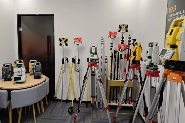
Welcome to RTKSurvey.com

Handheld SLAM LiDAR vs Terrestrial Laser Scanner: Which Is Better?
Handheld SLAM LiDAR scanners and terrestrial laser scanners can both produce detailed 3D point clouds, but they use different field workflows.
A handheld SLAM scanner captures data while the operator moves through an environment. A terrestrial laser scanner (TLS) typically collects data from fixed positions, with multiple scans registered together afterward.
For surveying companies, the important question is not simply which scanner is faster. It is which system can produce the required deliverables at an acceptable level of accuracy, completeness and cost.
Quick Answer: Handheld SLAM or Terrestrial Laser Scanner?
Choose handheld SLAM LiDAR when rapid coverage, portability and access to complex indoor spaces are priorities.
Choose terrestrial laser scanning when the project requires highly controlled measurements, detailed static scans or rigorous registration to survey control.
Both methods can produce valuable point clouds. Their suitability depends on the scanner model, site conditions, control network and accuracy requirements.
How Handheld SLAM LiDAR Works
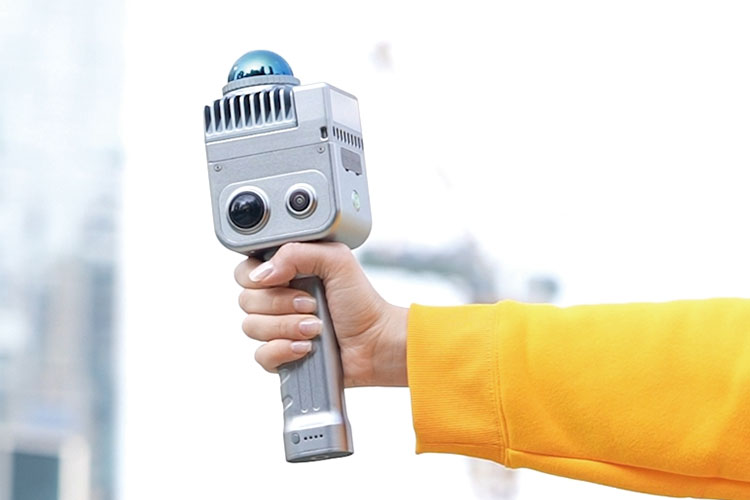
SLAM stands for Simultaneous Localization and Mapping.
A handheld SLAM scanner uses laser measurements, often combined with inertial sensors and other positioning information, to estimate its movement while building a 3D map.
The operator can walk through rooms, corridors, warehouses or industrial facilities without stopping to establish a new scanner position at every location.
This makes SLAM attractive for rapid as-built documentation and indoor mapping.
However, the estimated trajectory can gradually drift. Repetitive environments, long featureless corridors and insufficient overlap may reduce mapping reliability.
Explore our 3D Laser Scanners to see handheld SLAM systems available from different brands.
How Terrestrial Laser Scanning Works
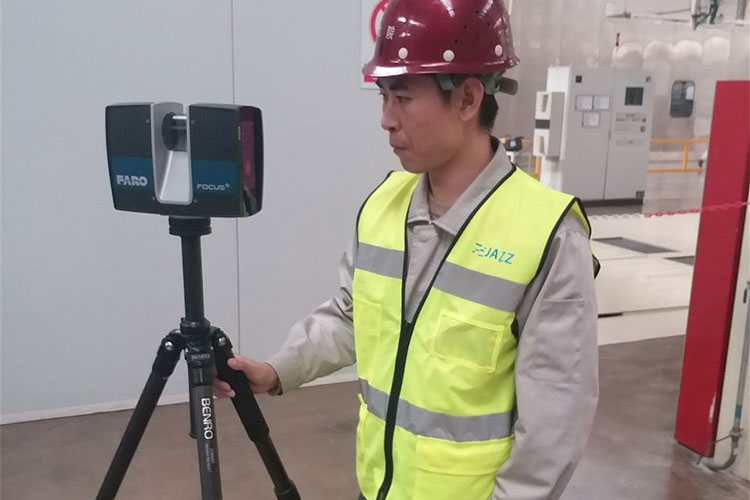
A terrestrial laser scanner collects measurements while positioned at a fixed location, commonly on a tripod.
The surveyor places the instrument at multiple positions to capture surfaces hidden from earlier viewpoints.
Individual scans are then registered into a common coordinate system using targets, overlapping geometry, survey control or a combination of methods.
TLS is useful when a project requires detailed documentation of structures, industrial equipment or construction geometry.
The main trade-off is the time required for scanner setups, movement between positions and registration.
Handheld SLAM LiDAR vs TLS: Comparison
| Factor | Handheld SLAM LiDAR | Terrestrial Laser Scanner |
|---|---|---|
| Data collection | Continuous movement | Stationary scan positions |
| Field speed | Often faster for large indoor walkthroughs | Depends on scan positions and settings |
| Accuracy | Sensitive to trajectory and SLAM processing | Sensitive to measurement quality and registration |
| Point cloud coverage | Efficient along accessible walking routes | Detailed views from planned stations |
| Main field risk | Drift and weak geometric features | Poor scan registration or insufficient overlap |
| Survey control | Important for validation and georeferencing | Important for registration and georeferencing |
| Typical use | Indoor mapping, warehouses, tunnels | Structural surveys, industrial documentation |
| Processing | Trajectory optimization and point cloud processing | Scan registration and point cloud processing |
Neither system is universally superior. Project specifications should determine the choice.
Accuracy: Why Scanner Specifications Are Not Enough
Manufacturers may publish ranging accuracy, relative accuracy or point cloud accuracy.
These are not interchangeable measurements.
For a handheld SLAM scanner, a highly accurate laser distance measurement does not guarantee that the entire mapped building will have the same positional accuracy.
Trajectory estimation, loop closure and control-point constraints can affect the final point cloud.
TLS also requires careful registration. Small errors between multiple scan positions can affect the combined dataset.
Before purchasing either system, ask how the manufacturer defines accuracy and under what conditions it was tested.
For projects with strict tolerances, verify the final point cloud against independently surveyed checkpoints.
Why Loop Closure Matters for SLAM Scanning
Loop closure occurs when the scanning system recognizes an area that it has previously visited.
This helps the processing software correct accumulated trajectory errors.
For example, consider scanning a warehouse with several long aisles.
Walking continuously from one end to the other without revisiting recognizable areas may increase the risk of drift.
A route that reconnects through previously scanned areas can provide stronger geometric constraints.
Good SLAM field practice includes:
Planning routes with useful overlap
Revisiting recognizable locations when practical
Avoiding unnecessarily long featureless paths
Maintaining suitable walking speed and sensor visibility
Checking the processed point cloud for distortion
Loop closure improves reliability, but it does not guarantee that all errors have been eliminated.
Field Example: Scanning an Industrial Facility
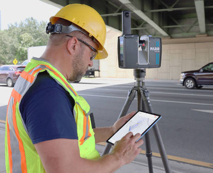
Consider a factory renovation project requiring an existing-condition model of production rooms, corridors and mechanical equipment.
A handheld SLAM scanner could be useful for quickly capturing accessible areas and creating a general spatial model.
However, critical equipment interfaces, structural connections or locations with tight installation tolerances may require additional controlled measurements.
A terrestrial laser scanner could provide detailed observations from carefully selected positions, with survey control used to check the registered point cloud.
For some projects, a combined approach is practical: use SLAM for broad coverage and controlled scanning or conventional survey measurements for critical geometry.
This is an illustrative workflow, not a claim about a specific completed project.
What Should Buyers Check Before Purchasing?
Instead of comparing only advertised scanning speed or maximum range, evaluate the complete system.
| Buying Question | Why It Matters |
|---|---|
| What accuracy is required for the final deliverable? | Determines whether the system is suitable |
| How is accuracy specified and tested? | Prevents misleading comparisons |
| Can the system use survey control points? | Supports validation and georeferencing |
| What happens in long or repetitive corridors? | Helps assess SLAM reliability |
| What point cloud formats are supported? | Affects CAD and BIM workflows |
| What software licenses are required? | Influences total ownership cost |
| How long does processing take? | Affects project delivery time |
| Is training and technical support available? | Helps teams adopt the system |
Whenever possible, request a representative point cloud dataset and evaluate it in the software your team intends to use.
Final Thoughts
Handheld SLAM LiDAR is particularly valuable when a survey team needs to capture complex environments quickly and efficiently.
Terrestrial laser scanning remains a strong choice for controlled measurements and detailed documentation where the survey workflow can accommodate fixed scanner positions.
For many professional projects, the deciding factors are not just speed and equipment price, but the required accuracy, field conditions and final deliverables.
RTKSurvey.com supplies 3D Laser Scanners from multiple brands for international surveying and engineering customers.
For a broader introduction to scanning technology, read our guide What Is a 3D Laser Scanner? Types, Uses and Buying Tips.