Welcome to RTKSurvey.com

China GNSS RTK Receiver Suppliers: Brands, Products and Buying Guide
Buying a GNSS RTK receiver from China involves more than comparing prices or the number of satellite channels. For surveying companies, construction contractors and equipment distributors, the important questions are whether the receiver supports the intended correction service, works with the field software and accessories, and can be supported after delivery.
China is home to several established GNSS surveying equipment brands, and international buyers can source receivers through manufacturers, distributors or multi-brand suppliers. Each route has advantages depending on the equipment, project requirements and purchasing volume.
This guide explains what to compare when sourcing GNSS RTK receivers from China, with practical examples of common purchasing decisions.
Chinese GNSS RTK Receiver Brands to Consider
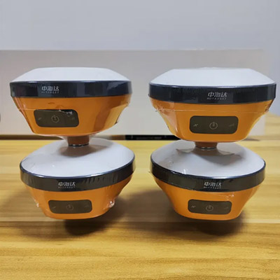
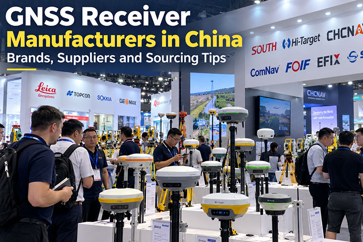
The Chinese surveying equipment market includes brands such as Hi-Target, CHCNAV, SOUTH, KOLIDA, FOIF, ComNav and EFIX. Their product ranges include conventional RTK receivers, IMU tilt-compensated models, visual surveying systems and equipment for local base-and-rover operations.
However, buyers should not assume that every receiver from the same brand has identical capabilities.
For example:
Conventional GNSS RTK receivers are suitable for many topographic, cadastral and construction surveying tasks.
IMU tilt-compensated receivers can improve field efficiency when a survey pole cannot be held perfectly vertical.
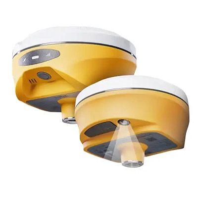
Visual or laser-enabled receivers may help measure certain difficult-to-reach points, subject to the model's actual capabilities and site conditions.
Dedicated base stations are useful where a project requires its own correction source rather than an external CORS service.
A receiver with more advertised features is not necessarily the best purchase. The right choice depends on how the equipment will be used.
Buyers can explore the GNSS RTK receivers available from RTKSurvey.com and compare models from different brands.
Case 1: A Surveying Contractor Needs RTK Equipment for Remote Road Projects
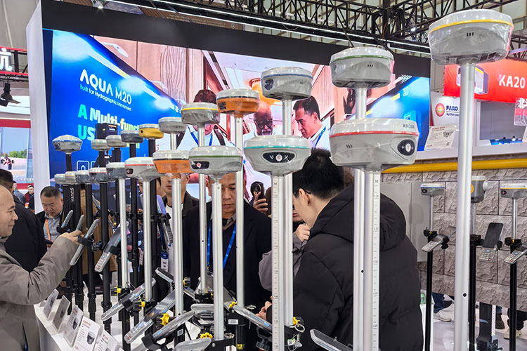
Illustrative purchasing scenario — not a documented customer project.
A surveying contractor plans to purchase four GNSS RTK receivers for road construction projects outside major towns. Some sites have unreliable mobile internet coverage.
The initial purchasing request is simple: four receivers with centimeter-level RTK capability.
But the communication environment changes the equipment requirements.
If the contractor purchases rover-only systems that depend entirely on internet-delivered NTRIP corrections, crews may be unable to work in areas without reliable mobile data.
A more appropriate configuration could include:
One GNSS base receiver capable of transmitting compatible UHF corrections.
Three rover receivers that support the required UHF frequency and radio protocol.
Field controllers and software compatible with the chosen receivers.
Suitable tripods, poles and other accessories.
A verified method for establishing and checking the base station coordinates.
Before ordering, the buyer should confirm radio interoperability, local frequency regulations and the practical limits of radio coverage. Hills, vegetation and terrain can interrupt radio corrections even when the equipment is operating correctly.
Purchasing lesson: The correction method and site environment should be established before selecting receiver models.
For a detailed comparison, see RTK Radio vs NTRIP: Which Correction Method Should You Use?.
Case 2: An Equipment Distributor Wants to Add a Chinese RTK Brand
Illustrative distributor scenario — not a documented RTKSurvey.com transaction.
An equipment distributor already sells total stations and surveying accessories. Customers are now asking for Chinese GNSS RTK receivers, but the distributor does not want to commit to a large quantity before testing the products.
Instead of selecting a receiver based only on its specification sheet, the distributor could begin with a small evaluation order.
The evaluation should cover three practical questions.
Will the receiver work with local correction services?
The distributor should test the receiver with an available NTRIP service, confirming the caster connection, mountpoint, correction format and coordinate reference system.
An RTK Fixed solution alone is not sufficient evidence that the delivered coordinates match the local survey control system.
Can surveyors use the software effectively?
The receiver may perform well technically but still be unsuitable if the field software lacks the required coordinate transformation tools, stakeout workflow, language options or data export formats.
Can the supplier support repeat orders?
The distributor should confirm the exact model configuration, included accessories, warranty terms, available documentation and arrangements for handling service issues.
Purchasing lesson: For distributors, repeatable product configuration and support can matter as much as the receiver's headline specifications.
What Should Buyers Compare Before Ordering?

The following points are particularly important when evaluating a China GNSS receiver supplier.
| Purchasing factor | What to confirm |
|---|---|
| Correction methods | NTRIP, compatible UHF radio, or both |
| GNSS performance | Supported constellations, frequencies and published accuracy conditions |
| Tilt measurement | IMU availability, initialization requirements and practical limitations |
| Field software | Coordinate systems, localization, stakeout and data export |
| Compatibility | Radio protocols, RTCM support, controllers and accessories |
| Package contents | Receiver, controller, pole, charger, case and other included items |
| Support | Documentation, warranty handling and after-sales arrangements |
Published RTK accuracy specifications usually describe performance under defined conditions. Actual field results depend on satellite visibility, multipath, correction quality, baseline length and survey procedures.
For example, a receiver operating near tall buildings may have difficulty maintaining reliable positioning even when the NTRIP connection is stable.
The equipment should therefore be evaluated against the actual project environment rather than a single accuracy figure.
Buying from a Manufacturer or a Multi-Brand Supplier in China
International buyers may contact a GNSS manufacturer directly or purchase through a surveying equipment supplier.
A manufacturer may be appropriate when a buyer is seeking a specific brand, an established distribution arrangement or a manufacturer-managed product program.
A multi-brand supplier can be useful when the buyer wants to compare several equipment options or source GNSS receivers together with total stations, controllers and surveying accessories.
Neither route automatically guarantees lower prices, better technical support or faster delivery. These factors depend on the specific company and order.
RTKSurvey.com is a China-based surveying equipment supplier, not a GNSS receiver manufacturer. Operated by Nanjing RTK Surveying Instruments Co., Ltd., the company supplies surveying instruments and accessories to international professional buyers.
Our role is to help customers identify suitable equipment, compare available models and coordinate purchasing requirements.
Learn more about RTKSurvey.com.
For a closer look at Chinese GNSS brands and manufacturing companies, read our GNSS Receiver Manufacturers in China guide.
How to Request a Useful GNSS RTK Quotation
A quotation request is more effective when it explains the intended application.
Instead of asking only for the price of a GNSS receiver, buyers can provide:
Application: Land surveying, construction stakeout, road work or another task.
Quantity: Number of rover units and whether a local base station is needed.
Correction source: Local CORS/NTRIP service, UHF base station or both.
Country of use: To help check communication and equipment requirements.
Existing equipment: Controllers, software or receivers that must work together.
Package requirements: Accessories, documentation and preferred shipping arrangement.
This information helps avoid quotations for configurations that appear similar but are not equally suitable.
Frequently Asked Questions
Are Chinese GNSS RTK receivers suitable for professional surveying?
Many Chinese GNSS brands offer equipment intended for professional surveying. Suitability depends on the specific model, measurement requirements, field conditions, software and the user's verification procedures.
Is a Chinese GNSS RTK receiver always cheaper?
Not necessarily. Prices vary with receiver capabilities, software, accessories, purchase quantity and support arrangements. Buyers should compare complete packages rather than receiver-only prices.
Can a GNSS receiver from China connect to a local CORS network?
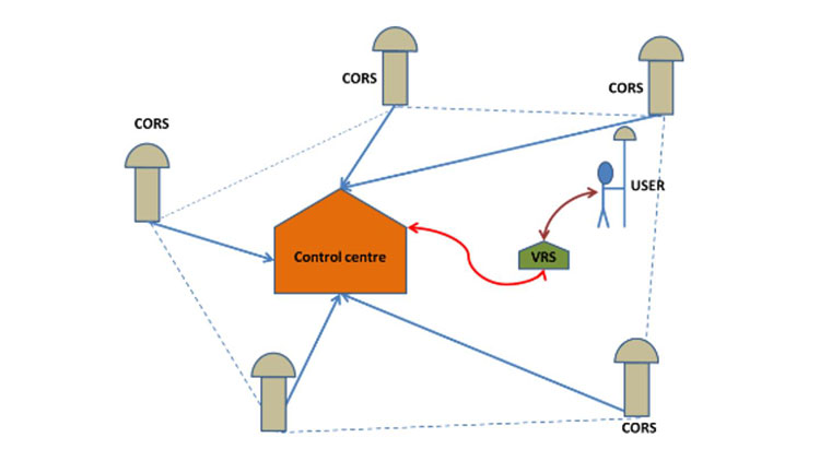
Many professional models support NTRIP corrections, but compatibility should be checked against the local service, including correction format, mountpoint requirements and reference system. See What Is CORS in GNSS Surveying?.
Can different GNSS RTK receiver brands work together?
Sometimes, provided the required correction protocols and data formats are supported. Compatibility should be verified for the specific base, rover, radio configuration and field software rather than assumed from the brand names.
Where can I buy GNSS RTK receivers from China?
International buyers can purchase through manufacturers, distributors and surveying equipment suppliers. RTKSurvey.com offers multiple GNSS receiver brands and can assist with product inquiries and sourcing requirements.
Source GNSS RTK Receivers from China
The most useful GNSS receiver is the one that fits the survey workflow, correction infrastructure and operating environment.
Whether you are purchasing a small number of RTK receivers for field crews or evaluating equipment for distribution, clear technical requirements make supplier comparisons more meaningful.
Explore our GNSS Receivers or contact RTKSurvey.com to discuss suitable models, configurations and purchasing requirements.