Welcome to RTKSurvey.com

Single Beam vs Multibeam Echo Sounder: Which One Do You Need?
Choosing between a single beam and a multibeam echo sounder is one of the first decisions in planning a hydrographic survey.
Both systems use sound waves to measure water depth, but they collect data differently. The right choice depends on the survey area, required bottom coverage, project budget and intended use of the results.
Quick Answer: Single Beam or Multibeam?
Choose a single beam echo sounder when you need depth profiles along planned survey lines, routine river or reservoir measurements, or a relatively economical hydrographic setup.
Choose a multibeam echo sounder when the project requires detailed seabed mapping, extensive bottom coverage, underwater feature detection or dense bathymetric data.
Neither system is automatically more accurate in every situation. Survey quality depends on the equipment configuration, positioning, calibration and data processing.
How Does a Single Beam Echo Sounder Work?
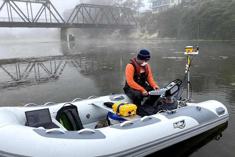
A single beam echo sounder (SBES) sends an acoustic pulse toward the bottom and measures the time required for the echo to return.
It produces depth observations beneath the survey vessel along its travel path.
Single beam systems are commonly used for:
River and channel cross-section surveys
Reservoir depth measurements
Routine inland waterway surveys
Construction-related depth checks
Bathymetric profiles along planned survey lines
Their main advantages are simpler equipment integration, manageable data volumes and generally lower system costs.
However, the areas between survey lines remain less directly measured. Narrow hazards or unexpected bottom features may be missed if the survey pattern is too widely spaced.
How Does a Multibeam Echo Sounder Work?
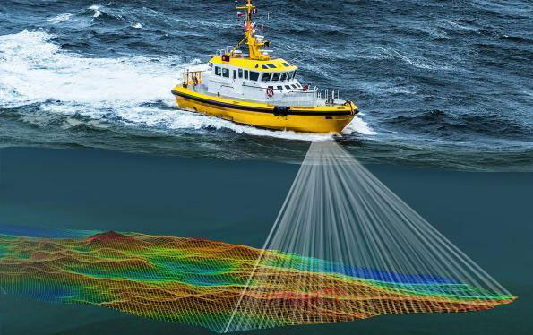
A multibeam echo sounder (MBES) transmits and receives acoustic signals across multiple directions, collecting many depth measurements within a swath beneath and beside the vessel.
As the vessel moves, the system builds a detailed representation of the underwater terrain.
Multibeam systems are particularly useful for:
Port and harbor surveys
Dredging and seabed monitoring
Underwater obstruction investigations
Detailed bathymetric mapping
Engineering projects requiring dense depth data
The wider coverage provides substantially more information about the shape of the bottom than a conventional single beam survey.
However, multibeam systems usually require more complex installation, calibration, motion compensation and data processing.
Single Beam vs Multibeam Echo Sounder: Comparison
| Feature | Single Beam | Multibeam |
|---|---|---|
| Data collection | Depths along survey tracks | Multiple depths across a swath |
| Bottom coverage | Limited by beam footprint and line spacing | Broad coverage with suitable line planning |
| Data density | Relatively low | High |
| Equipment cost | Generally lower | Generally higher |
| System complexity | Simpler | More complex |
| Processing workload | Usually lighter | Usually greater |
| Typical applications | River profiles, routine depth surveys | Detailed seabed mapping, ports, dredging |
Which Echo Sounder Is More Accurate?
It is a mistake to assume that multibeam automatically means better depth accuracy.
A properly calibrated single beam system can deliver reliable depth measurements along its survey lines.
A multibeam system offers much denser spatial coverage, but individual soundings can still be affected by sound velocity errors, vessel motion, positioning uncertainty and installation offsets.
The distinction is between measurement accuracy and bottom coverage.
For example, a single beam survey may accurately measure depths along a river centerline while leaving a submerged object between adjacent lines undetected.
A multibeam survey can provide a more complete picture of the bottom, provided the survey design and processing are appropriate.
Field Example: Surveying a Reservoir
Consider a reservoir survey intended to estimate storage capacity and identify changes in bottom elevation.
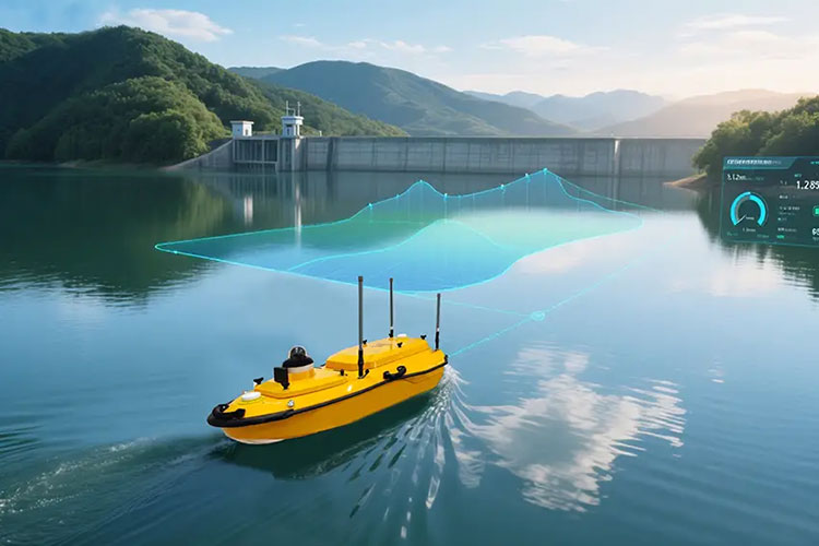
For a preliminary assessment, a single beam echo sounder mounted on a small survey boat may provide useful depth profiles at planned intervals.
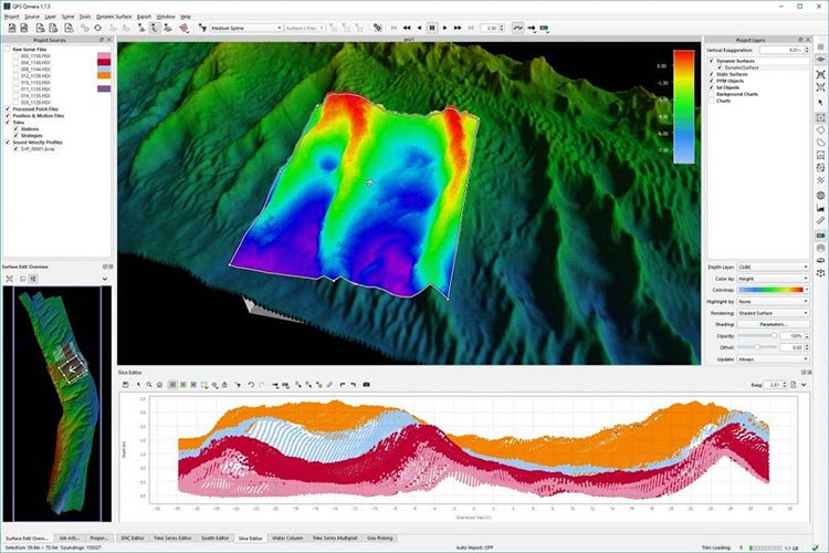
The surveyor can combine these observations with positioning data to build a bathymetric model.
If the project later requires detailed mapping near a dam structure or identification of small underwater obstructions, a multibeam system may be more suitable.
This is a hypothetical example, but it illustrates why the survey objective should determine the equipment choice.
What Else Affects Hydrographic Survey Results?
The echo sounder is only one component of the survey system.
Reliable results also require attention to:
GNSS Positioning
The vessel's position must be recorded accurately and synchronized with the depth observations.
GNSS RTK can provide precise positioning where correction services, satellite reception and operating conditions are suitable.
Sound Velocity
Acoustic travel time must be converted into distance using an appropriate sound-speed value or profile.
Changes in water temperature, salinity and pressure can affect sound velocity and therefore depth calculations.
Vessel Motion and Sensor Offsets
Pitch, roll, heave and heading can affect the location of measured points, especially in multibeam surveys.
Correct sensor alignment, offsets and motion compensation are essential.
Water-Level Corrections
Depending on the project, measured depths may need to be referenced to a specified vertical datum using tide observations, water-level measurements or an approved GNSS-based method.
How to Choose the Right Echo Sounder
Before purchasing, ask these questions:
Do you need depth profiles or detailed bottom coverage?
Is the survey in a river, reservoir, harbor or coastal area?
What accuracy and coverage requirements apply?
Will the system be installed on a conventional boat or an unmanned survey boat?
Do you have suitable positioning, motion sensors and processing software?
What are the available budget and operator training resources?
For projects with strict hydrographic requirements, check the applicable survey specifications, including the relevant IHO S-44 survey order.
Explore our Echo Sounders to compare single beam and multibeam equipment options.
Final Thoughts
Single beam echo sounders remain practical tools for many river, reservoir and routine depth surveys.
Multibeam echo sounders provide the denser bottom coverage needed for more detailed hydrographic mapping and underwater feature investigations.
The best choice is not necessarily the most expensive system. It is the one that meets the project's technical requirements with an appropriate balance of coverage, complexity and cost.
RTKSurvey.com supplies hydrographic survey equipment, including echo sounders and unmanned survey boats, for international surveying and engineering customers.