Welcome to RTKSurvey.com

Unmanned Survey Boat vs Traditional Survey Boat: Which Is Better?
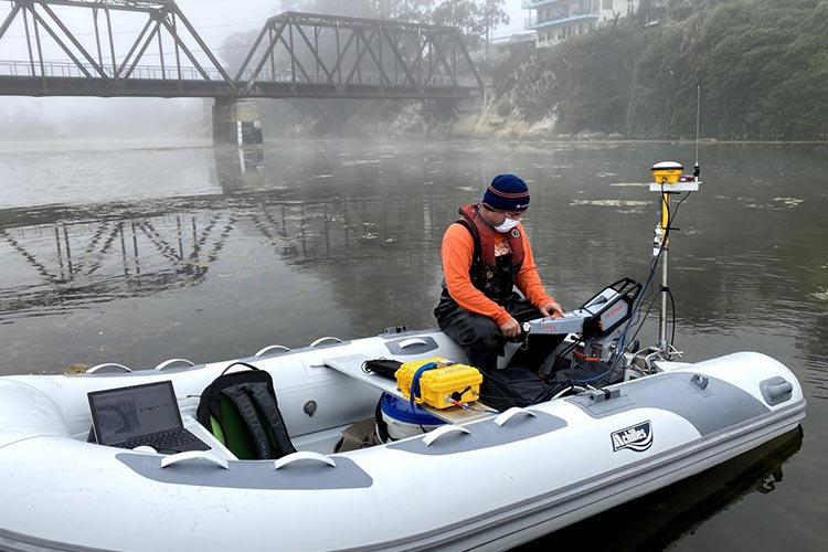
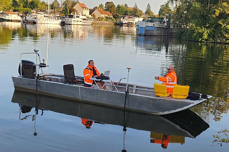
Hydrographic survey teams traditionally use crewed boats to carry echo sounders, GNSS receivers and other measurement equipment. Today, unmanned survey boats are another option for collecting bathymetric data, especially in shallow or difficult-to-access waters.
But does an unmanned survey boat always offer a better solution?
The answer depends on the survey environment, required equipment, operational risks and project scale.
Quick Answer: Unmanned or Traditional Survey Boat?
Choose an unmanned survey boat (USV) for suitable shallow-water surveys, small reservoirs, restricted-access areas and repeatable survey routes where remote operation can reduce the need to place personnel onboard.
Choose a traditional crewed survey boat when the project requires larger payloads, extensive onboard operations, long working periods or direct intervention by survey personnel.
Both platforms can produce high-quality hydrographic data when properly equipped, calibrated and operated.
What Is an Unmanned Survey Boat?
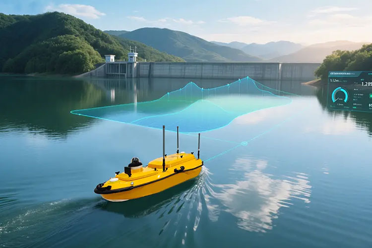
An unmanned survey boat, also known as an unmanned surface vehicle (USV), is a watercraft that performs survey operations without a person onboard.
Depending on the model, it may be remotely controlled or follow predefined survey lines under operator supervision.
A typical hydrographic USV system may include:
GNSS positioning equipment
Single beam or multibeam echo sounder
Navigation and mission-planning software
Wireless communication equipment
Batteries and propulsion system
Obstacle detection or other safety features, depending on configuration
The operator usually monitors the vessel from shore or another support platform.
Explore our Unmanned Survey Boats to see available USV systems for hydrographic applications.
Unmanned vs Traditional Survey Boats: Key Differences
| Feature | Unmanned Survey Boat | Traditional Survey Boat |
|---|---|---|
| Onboard crew | No | Yes |
| Operation | Remote or supervised autonomous | Onboard crew |
| Shallow-water access | Often advantageous with compact USVs | Depends on vessel draft |
| Payload capacity | Limited by USV size and design | Often greater on larger vessels |
| Deployment | Portable models can be convenient | May require launching facilities |
| Operating endurance | Depends on battery or fuel system | Depends on vessel and fuel capacity |
| Personnel exposure | No crew onboard during survey | Crew exposed to water conditions |
| Equipment maintenance | Often requires retrieval | Some tasks possible onboard |
The comparison describes typical systems, not universal performance limits. Large professional USVs may offer substantially different capabilities from compact battery-powered models.
1. Safety in Difficult Survey Environments
One of the strongest reasons to use an unmanned survey boat is to reduce personnel exposure.
For example, surveying a shallow industrial pond or reservoir with uncertain underwater obstacles may create unnecessary risks for a small crewed boat.
A compact USV can collect measurements while the operator remains at a suitable control position.
However, unmanned operation does not eliminate risk. Operators must still consider other vessels, communication loss, weather, launch and recovery hazards, and applicable navigation regulations.
USVs require appropriate supervision and emergency procedures.
2. Access to Shallow and Restricted Waters
Compact unmanned survey boats can be particularly useful in locations where conventional survey vessels are difficult to operate.
Examples include:
Small reservoirs and retention ponds
Shallow river sections
Nearshore survey areas
Waterways with limited launching access
Certain construction and dredging sites
A small USV may operate with less draft than a larger crewed vessel, although actual minimum operating depth depends on hull design, propulsion and sonar installation.
For deeper offshore work or exposed waters, a larger crewed vessel or a suitably designed professional USV may be more appropriate.
3. Survey Efficiency and Operating Costs
An unmanned survey boat may reduce crew requirements and simplify deployment for some projects.
Preplanned survey lines can also help maintain consistent coverage during repeated bathymetric surveys.
However, purchasing a USV does not automatically make every survey cheaper.
The total operating cost should include:
Boat and sonar equipment
GNSS positioning and correction services
Operator training
Transportation and deployment
Maintenance and replacement batteries
Data processing and quality control
Safety supervision and recovery arrangements
For a small reservoir project, a portable USV may be economical.
For a large offshore project involving heavy sensors and extended operations, a traditional survey vessel may remain the more practical choice.
4. Does an Unmanned Survey Boat Improve Accuracy?
A USV is a survey platform, not an accuracy specification.
Depth measurement quality depends primarily on the sonar, positioning system, sensor installation, calibration and environmental corrections.
For example, a USV carrying a properly configured single beam echo sounder can collect reliable depth profiles.
A crewed vessel with a multibeam system may provide much denser bottom coverage.
Conversely, some professional USVs can carry multibeam systems and collect detailed bathymetric data.
Therefore, compare the complete measurement system rather than assuming that either vessel type is inherently more accurate.
For more information about sonar selection, see our article Single Beam vs Multibeam Echo Sounder: Which One Do You Need?.
Field Example: Reservoir Sedimentation Monitoring
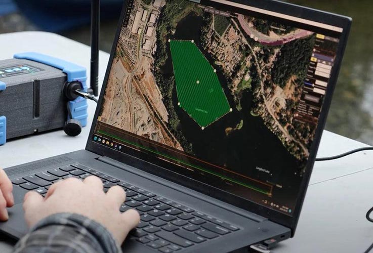
Consider a reservoir that requires periodic bathymetric surveys to monitor sediment accumulation.
A compact USV equipped with GNSS positioning and a single beam echo sounder could follow planned survey lines at regular intervals.
Using consistent survey methods, coordinate references and water-level corrections helps make measurements from different dates comparable.
If the project requires detailed investigation around intake structures or underwater obstacles, a more advanced sonar configuration may be necessary.
This is an illustrative workflow rather than a documented project result.
What to Check Before Buying an Unmanned Survey Boat
Before selecting a USV, ask the supplier:
Which echo sounders are supported?
Does the system include GNSS RTK positioning?
What are the operating endurance and charging requirements?
How does the vessel respond to communication loss?
What are the wind, wave and current operating limits?
Can survey routes be planned and monitored?
What data formats and processing software are supported?
What maintenance, spare parts and technical support are available?
These questions help determine whether the proposed boat can meet actual survey requirements.
Final Thoughts
Unmanned survey boats are valuable tools for shallow-water mapping, reservoir monitoring and other suitable hydrographic applications.
Traditional survey boats remain important for projects requiring larger payloads, onboard operations or extended work in demanding environments.
The most effective choice depends on the survey objective, environmental conditions and complete equipment configuration.
RTKSurvey.com supplies hydrographic survey equipment for international customers, including Unmanned Survey Boats and Echo Sounders. Contact our team to discuss suitable equipment options for your survey project.