Welcome to RTKSurvey.com

What Is an RTK GNSS Receiver? A Practical Guide for Surveying
An RTK GNSS receiver is a precision positioning instrument used to determine survey points in real time. Unlike ordinary navigation receivers, survey-grade RTK equipment processes satellite observations together with correction data to calculate highly precise positions.
For land surveyors, construction teams and mapping professionals, the practical advantage is speed. A properly configured RTK system can provide centimeter-level positioning under suitable conditions, allowing crews to collect coordinates, stake out design points and verify site features without waiting for conventional post-processing.
However, selecting an RTK receiver involves more than comparing advertised accuracy figures. Correction availability, satellite visibility, coordinate settings, field software and working conditions all influence the results.
This guide explains how RTK GNSS receivers work, where they perform well and what to check before choosing a system.
How Does an RTK GNSS Receiver Work?
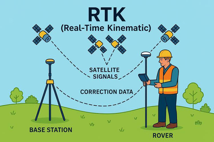
GNSS stands for Global Navigation Satellite System. It includes satellite constellations such as GPS, Galileo, GLONASS and BeiDou.
A GNSS receiver determines its position using signals transmitted by satellites. However, standalone positioning is affected by several error sources, including atmospheric delays, satellite-related errors and signal reflections.
Real-Time Kinematic, or RTK, improves positioning by using carrier-phase measurements and correction information from a reference station or positioning network.
The Role of the Base Station
In a conventional base-and-rover configuration, the base station is installed at a stable location. It tracks GNSS satellites and sends observation data or corrections to the rover.
For survey work tied to a specified coordinate reference system, the base station must have appropriately established coordinates. An incorrect base position can introduce a systematic offset into the rover results, even when the rover reports an RTK fixed solution.
The Role of the Rover
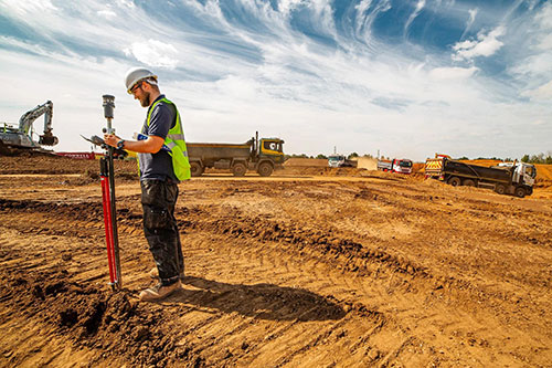
The rover is the mobile GNSS receiver used to measure survey points.
It combines its satellite observations with the incoming reference information to calculate a precise position relative to the base station or reference network.
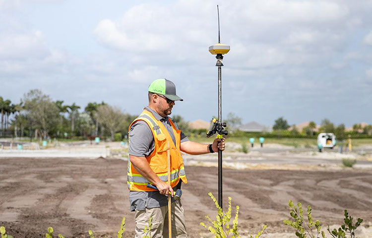
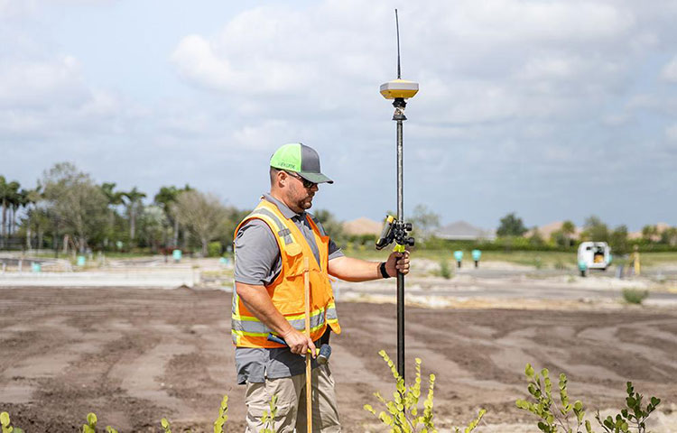
A surveyor typically operates the rover using a pole and a field controller. The controller manages survey jobs, coordinate settings, point collection and stakeout operations.
How Corrections Reach the Rover
Two common methods are used:
Radio RTK: A local base station transmits corrections through a compatible radio link.
Network RTK: The rover receives correction data from a reference station network, commonly through an internet connection using NTRIP.
Neither method is universally better. The right choice depends on network coverage, radio conditions, project location and operational requirements.
RTK Fixed vs. Float: Why the Difference Matters
A survey controller may display different positioning states during fieldwork.
RTK Fixed
A fixed solution indicates that the receiver has resolved the carrier-phase integer ambiguities used in its RTK calculation.
This is generally the preferred positioning state for high-precision RTK survey observations.
However, Fixed does not automatically mean that every recorded coordinate is correct. Incorrect antenna height, unsuitable coordinate transformations, wrong base coordinates or signal multipath can still affect a measurement.
RTK Float
A float solution means the receiver has not resolved the carrier-phase ambiguities to a fixed solution.
Float positioning may still be useful for certain lower-precision tasks, but it should not be treated as equivalent to a validated fixed solution.
For survey points with strict accuracy requirements, the crew should follow the project's acceptance criteria rather than relying on the status label alone.
Where Do RTK GNSS Receivers Work Best?
RTK is especially useful where survey crews need to measure many points across accessible outdoor areas.
Open-Sky Land Surveying
Sites with clear satellite visibility generally provide more favorable GNSS conditions.
Typical applications include topographic surveys, terrain mapping, boundary-related field measurements and control checks, subject to local professional standards.
Construction Layout and Stakeout
RTK receivers can help crews locate design coordinates for roads, earthworks, utilities and construction features.
The field controller guides the operator toward a target point, while the receiver supplies the current position.
Before starting stakeout, the survey team should verify the project coordinate system and check the setup against reliable control points.
Mapping and Infrastructure Projects
RTK equipment is also used for collecting coordinates of roads, drainage features, utility assets and other mapped objects.
Its efficiency is particularly valuable when many features must be recorded over a large area.
When Is RTK GNSS Not the Best Choice?
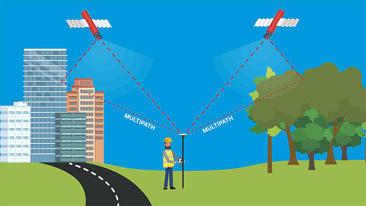
RTK performance can deteriorate where satellite signals are blocked, reflected or otherwise disturbed.
Common challenging environments include:
Dense tree canopy
Narrow streets between tall buildings
Areas near large metal structures
Tunnels and indoor environments
Sites with unreliable correction communication
Signal reflections, known as multipath, can introduce errors that are not always obvious from the displayed position status.
In these conditions, moving the observation point, changing the survey method or using a total station may be more appropriate.
A modern RTK receiver with IMU tilt compensation can make some field measurements more convenient, but tilt compensation does not eliminate satellite visibility or correction-quality limitations.
Local Base and Rover vs. Network RTK
The correction method is one of the most important purchasing decisions.
| Consideration | Local Base and Rover | Network RTK |
|---|---|---|
| Reference source | Survey team's own base station | Existing reference station network |
| Communication | Usually radio or another local link | Usually cellular internet |
| Setup | Requires local base installation | Requires network access and configuration |
| Field flexibility | Useful where suitable networks are unavailable | Convenient where reliable services exist |
| Key dependency | Base coordinates and communication coverage | Network availability, compatibility and coverage |
A local base-and-rover system may be practical for remote projects without dependable cellular service.
Network RTK can reduce equipment setup time where reliable reference services are available.
Before purchasing, confirm whether the intended correction service is supported by the receiver and field software. Also check any subscription, communication and data-plan requirements.
Six Things to Check Before Choosing an RTK GNSS Receiver
1. Correction Compatibility
Determine whether the project will use a local base, a network RTK service or both.
Check supported correction formats, radio compatibility and NTRIP connectivity. Avoid assuming that equipment from different brands will work together without configuration.
2. Satellite Tracking Capabilities
Multi-constellation tracking can improve the availability of satellite observations.
However, a high advertised channel count does not by itself establish field accuracy. Receiver processing, antenna performance, signal environment and correction quality also matter.
3. Field Controller and Software
The controller is part of the complete surveying workflow.
Check whether the software supports the coordinate systems, data formats, stakeout functions and export procedures required by your team.
Also consider usability, language support and the availability of technical assistance.
4. IMU Tilt Compensation
Tilt compensation may help surveyors measure points without holding the pole perfectly vertical, within the supported operating conditions of the specific receiver.
Compare actual tilt limitations, initialization requirements and accuracy claims using verified product documentation.
5. Power and Field Durability
Consider expected working hours, charging methods, weather protection and operating temperatures.
For remote projects, the practical availability of charging equipment and spare power sources can be as important as headline battery-life specifications.
6. Service and Equipment Compatibility
A receiver should fit the rest of the surveying workflow.
Before ordering, confirm compatibility with existing controllers, software, correction services, poles and accessories. Ask about warranty terms, firmware support and after-sales assistance.
A Practical RTK Field Checklist
Before collecting important survey points, review the following steps.
Before Leaving the Office
Confirm the required coordinate reference system and vertical datum.
Check the availability of base-station or network corrections.
Verify controller software, project files and export formats.
Charge equipment and inspect cables, poles and mounts.
Identify suitable control points for field verification.
At the Survey Site
Select stable locations with good satellite visibility.
Verify the base coordinates if using a local base station.
Enter and check antenna and pole heights.
Confirm that the correct correction stream is active.
Check measured positions against known control points.
During Point Collection
Monitor the positioning solution and correction status.
Watch for obstructions, reflections and communication interruptions.
Record independent check observations where required.
Follow the project's tolerance and quality-control procedures.
Investigate unexpected differences before accepting critical points.
A disciplined workflow helps reduce the risk of collecting coordinates that appear precise but do not meet project requirements.
How RTKSurvey.com Can Help You Choose Equipment
RTKSurvey.com supplies surveying instruments and accessories for professional field applications, including GNSS RTK receivers, total stations, survey data collectors and surveying poles.
Different projects may require different receiver configurations. A contractor working primarily in areas with reliable network coverage may have different requirements from a surveying company operating in remote regions.
When comparing equipment, it helps to provide the intended applications, working environment, correction method, software requirements and preferred accessories.
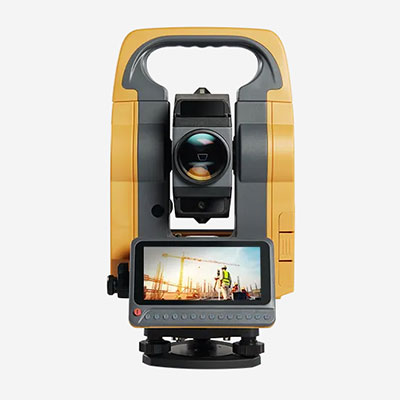
Explore our GNSS Receivers category to compare available equipment. You can also browse Total Stations for projects where conventional optical surveying methods are appropriate.
For controllers, poles and other field equipment, visit our Surveying Accessories section.
Frequently Asked Questions
Can an RTK GNSS Receiver Achieve Centimeter-Level Accuracy?
Yes, centimeter-level positioning is achievable under suitable conditions with appropriate equipment, corrections and survey procedures. Actual results depend on the complete setup and should be checked against project accuracy requirements.
Does an RTK Receiver Always Need Internet Access?
No. A local base station can deliver corrections through a compatible radio link without cellular internet. Network RTK commonly requires an internet connection.
Is an RTK Fixed Solution Always Accurate?
No. A fixed solution is an important positioning indicator, but it does not independently verify the coordinate system, antenna height, base coordinates or freedom from measurement errors.
Can RTK GNSS Replace a Total Station?
Not in every situation. RTK is highly efficient in suitable outdoor environments, while total stations remain valuable where satellite visibility is limited or specific measurement methods are required.
What Should I Ask a Supplier Before Ordering?
Confirm correction compatibility, controller and software options, supported field functions, accessories, warranty conditions and technical support. The best configuration depends on how and where the equipment will be used.
Conclusion
An RTK GNSS receiver is more than a device that displays precise coordinates. It is one component of a surveying system that depends on satellite observations, reliable corrections, suitable coordinate settings and consistent field procedures.
Understanding these factors makes it easier to choose equipment that matches real project requirements rather than relying on specifications alone.
For surveying companies, equipment dealers and contractors comparing GNSS RTK solutions, RTKSurvey.com offers a range of receivers and related surveying equipment for different field applications.