Welcome to RTKSurvey.com

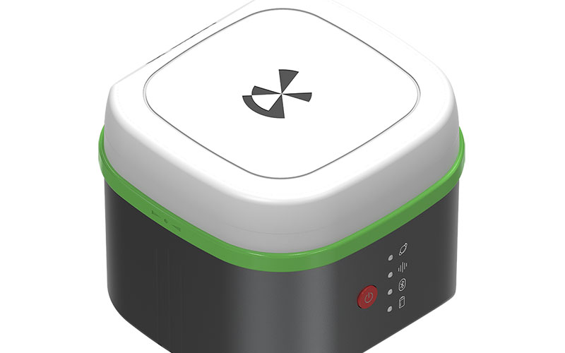
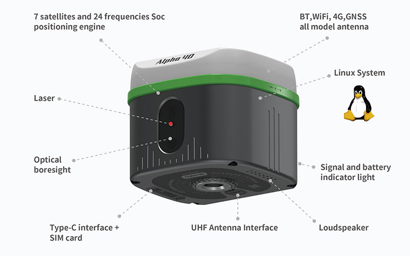
Alpha 40 Laser AR GNSS RTK Receiver
The Alpha 40 Laser AR GNSS RTK Receiver is an optic-electric surveying receiver that combines GNSS RTK positioning, laser measurement, optical calibration, inertial navigation and dual-camera AR guidance in one compact unit.
Its laser measurement capability allows surveyors to collect points that are difficult or unsafe to occupy directly. The integrated inertial navigation system supports tilt compensation up to 60°, while the AR camera system provides visual assistance for surveying and stakeout workflows.
The Alpha 40 is also designed to support drone and unmanned-system positioning workflows, making it suitable for professional survey teams working across construction, infrastructure and mapping projects.
RTKSurvey.com supplies the Alpha 40 for professional surveying and non-contact measurement applications.
Key Features
1408-channel multi-constellation GNSS positioning
Integrated laser measurement
Laser range up to 50 m
±1 mm laser measurement accuracy
Optical calibration for non-contact measurement
Dual-camera AR guidance
0–60° tilt compensation
200 Hz inertial measurement update rate
Integrated 2 W UHF radio and LoRa
4G, Wi-Fi and Bluetooth connectivity
Compact 680 g design
Core Specifications
GNSS channels: 1408
Satellite systems: GPS, BDS, GLONASS, Galileo, QZSS, SBAS and NavIC
RTK accuracy: H ±(8 mm + 1 ppm), V ±(15 mm + 1 ppm)
Static accuracy: H ±(2.5 mm + 0.5 ppm), V ±(5 mm + 0.5 ppm)
Tilt range: 0–60°
Tilt compensation accuracy: ±(8 mm + 0.3 mm/°)
IMU update rate: 200 Hz
Laser range: Up to 50 m
Laser accuracy: ±1 mm
UHF radio: 2 W, 410–470 MHz
Operating time: Up to 18 h NTRIP / 15 h radio receiving / 8 h radio transmitting
Memory: 32 GB
Weight: Approx. 680 g
Protection: IP67
Dimensions: 100 × 100 × 80 mm
Applications
Land surveying
Non-contact point measurement
Construction layout
Engineering surveying
Topographic mapping
Building and structural surveying
Road and infrastructure projects
Difficult-to-access point measurement
Drone and unmanned-system positioning



