Welcome to RTKSurvey.com

GNSS RTK Under Trees: Why Accuracy Drops and How to Improve It
Working with GNSS RTK under trees can be frustrating. A receiver may obtain a Fixed solution in an open field, then struggle to maintain that solution only a few meters inside a wooded area.
Sometimes the rover continues displaying Fixed, but repeated measurements of the same point do not agree.
Why does this happen, and what should surveyors do when reliable coordinates are required beneath tree cover?
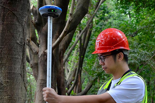
Why Does GNSS RTK Lose Accuracy Under Trees?
GNSS receivers calculate positions using satellite signals. Trees interfere with these signals in several ways.
1. Satellite Signal Blockage
Branches, trunks and dense foliage obstruct the receiver's view of the sky.
With fewer usable satellite observations, the receiver may have difficulty maintaining suitable satellite geometry or resolving carrier-phase ambiguities.
2. Multipath Interference
A GNSS signal can reach the antenna directly or after reflecting from nearby surfaces.
Under trees, reflected and distorted signals can introduce measurement errors that are difficult for the receiver to identify.
This means a Fixed solution does not automatically guarantee accurate coordinates.
3. Signal Attenuation
Leaves and branches weaken satellite signals. Wet vegetation can make signal reception more difficult.
A receiver that performs well beneath scattered trees may struggle under dense, overlapping crowns.
Can GNSS RTK Still Work Under Tree Canopy?
Yes, depending on the site conditions.
Modern multi-frequency, multi-constellation GNSS receivers can use signals from GPS, GLONASS, Galileo and BeiDou, subject to the receiver's capabilities and configuration.
This gives the positioning system more observations to work with when some satellites are obstructed.
However, additional satellite tracking cannot completely eliminate multipath or signal blockage.
The practical question is not simply whether the rover can obtain Fixed. It is whether the resulting coordinates meet the project's accuracy requirements.
How to Improve RTK Surveying Under Trees
1. Check the Sky Before Measuring
Look for openings between tree crowns and identify nearby positions with better satellite visibility.
Even a small change in antenna location can affect the quality of observations.
If the actual survey point cannot be occupied reliably, consider establishing control in an open area and transferring the position using an appropriate conventional survey method.
2. Monitor More Than the FIX Status
Before accepting a point, review the available quality indicators:
RTK solution status
Satellite geometry, including PDOP
Signal strength or quality indicators
Estimated horizontal and vertical precision
Correction age and communication status
These indicators help identify problems, but none provides a complete guarantee of actual accuracy.
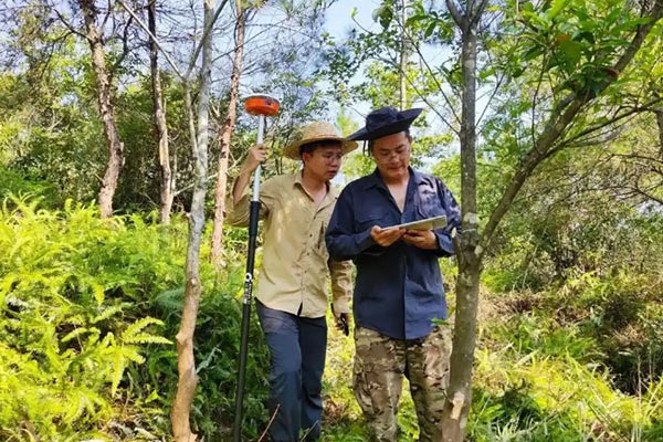
3. Measure Important Points Independently
For critical control or boundary work, do not rely on one short observation.
Where practical, move away, allow the receiver to reinitialize, and return for an independent measurement.
Compare the resulting coordinates against the project's tolerance.
A repeated measurement that agrees closely is useful evidence, although additional independent control checks may still be necessary.
4. Keep the Base Station in a Suitable Location
If using a local base-and-rover setup, place the base where it has stable satellite reception and a reliable correction link.
Putting the base beneath the same dense canopy as the rover does not solve the underlying signal problem.
For network RTK, verify that the correction service and mobile data connection remain reliable.
5. Know When to Use a Total Station
Dense forest conditions may be unsuitable for reliable RTK measurements.
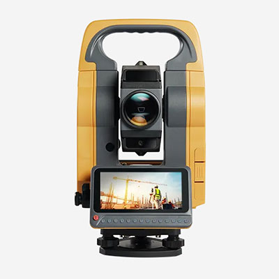
In these situations, a total station can be used to transfer coordinates from established control points into obstructed areas.
The correct method depends on visibility, access, project tolerances and available equipment.
Field Example: Surveying a Boundary Near a Wooded Area
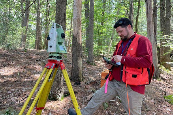
Consider a surveyor measuring boundary points along the edge of a construction site.
The first three points are located in open ground, and the GNSS rover produces consistent Fixed solutions.
The next point is beneath dense branches. The receiver eventually reports Fixed, but two independently initialized observations disagree beyond the project's allowable tolerance.
Instead of averaging the coordinates and accepting the result, the surveyor establishes control in a nearby open area and uses a total station to measure the obstructed point.
This hypothetical example illustrates an important principle: when GNSS observations cannot be verified, changing the measurement method is often more reliable than waiting indefinitely for a better FIX.
Does IMU Tilt Compensation Help Under Trees?
IMU tilt compensation can make it easier to measure points near trunks, fences and other obstacles without holding the pole perfectly vertical, provided the instrument is correctly configured and used within its specified limits.
However, tilt compensation does not repair blocked satellite signals or remove multipath errors.
It improves pole-handling flexibility, not the fundamental quality of GNSS observations.
Choosing a GNSS Receiver for Wooded Survey Sites
If surveying under partial tree cover is a regular requirement, consider:
Multi-frequency and multi-constellation tracking capabilities
Reliable RTK performance in obstructed environments
Clear field-controller quality indicators
Support for independent point checks and observation logging
Compatibility with your base station or network RTK service
Ask suppliers for relevant field-test information rather than relying only on advertised open-sky accuracy specifications.
Explore our GNSS RTK receivers to compare equipment options for different surveying applications.
Final Thoughts
GNSS RTK can work under trees, but successful positioning depends on more than obtaining a Fixed solution.
Tree canopy can block, weaken and reflect satellite signals, reducing measurement reliability.
Surveyors should evaluate site conditions, verify important coordinates independently and use conventional methods when GNSS observations cannot meet the required tolerance.
For additional troubleshooting, read our guide to GNSS RTK Not Getting Fixed.
RTKSurvey.com supplies GNSS receivers, total stations and surveying accessories for land surveying, construction and engineering projects worldwide.