Welcome to RTKSurvey.com



SpatiX X5 StellarLaser GeoSync GNSS RTK Receiver
The SpatiX X5 StellarLaser GeoSync GNSS RTK Receiver combines high-precision GNSS positioning, laser measurement and dual-camera AR stakeout in one integrated surveying solution. It is designed to improve field efficiency when surveyors need to measure difficult-to-access points or perform fast construction layout.
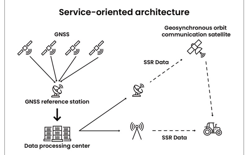
The integrated laser function allows points to be measured without placing the receiver directly over the target, while the dual-camera AR system provides visual guidance for stakeout operations. The X5 also supports SpatiX global NRTK and SSR positioning services for professional field applications.
RTKSurvey supplies the SpatiX X5 for surveying, mapping, construction and GIS applications.
Key Features
High-precision GNSS RTK positioning
Integrated laser measurement for difficult-to-access points
Dual-camera AR stakeout
SpatiX GeoSync positioning technology
Global NRTK and SSR correction services
Contactless measurement capability
Integrated workflow for surveying and construction layout
Compact design for professional field work
Core Specifications
Positioning: GNSS RTK
Correction services: NRTK / SSR
Measurement: Integrated laser measurement
Visual functions: Dual-camera AR stakeout
Technology: StellarLaser GeoSync
Positioning: Centimeter-level GNSS positioning
Applications
Land surveying
Topographic mapping
Boundary surveying
Construction layout
Difficult-to-access point measurement
GIS data collection
Precision agriculture



