Welcome to RTKSurvey.com

KOLIDA KTS-442UT Total Station
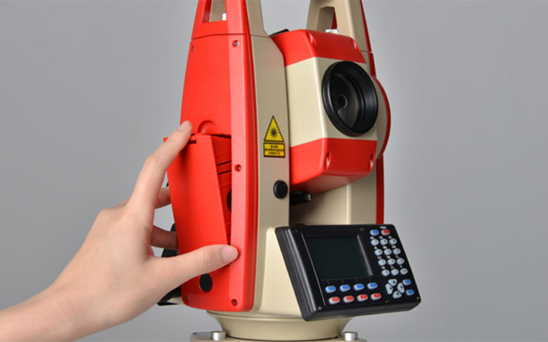
The KOLIDA KTS-442UT is a practical total station that combines conventional instrument operation with graphic surveying through the KSurvey Android application. It provides 2″ angular accuracy, up to 5000 m prism measurement and 1000 m reflectorless measurement, with a 1500 m reflectorless option.
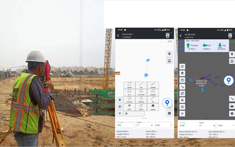
KTS-442UT users can connect an Android device running KSurvey to perform graphical measurement and stakeout. CAD basemaps can be imported for point and line stakeout, while measured points can be organized and displayed graphically in the field.
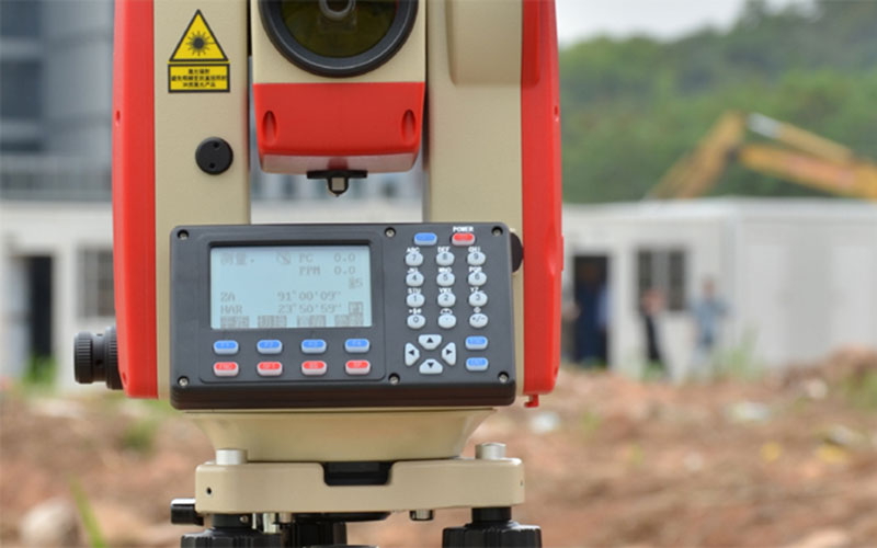
The total station itself uses a full alphanumeric keyboard, backlit keys and a trigger key. It also provides Bluetooth communication, USB storage and onboard programs for coordinate measurement, area calculation, road design and stakeout.
Key Features
2″ angular accuracy
1″ or 5″ minimum reading options
Up to 5000 m single-prism range
Up to 8000–10000 m with three prisms
1000 m reflectorless measurement
1500 m reflectorless option
2 mm + 2 ppm prism accuracy
3 mm + 2 ppm reflectorless accuracy
KSurvey Android App support
Graphic point and line stakeout
CAD basemap import
Graphic measurement and drawing
Up to 100,000 internal data points
USB flash storage support
Bluetooth communication
Laser pointer and laser plummet
Up to 20 hours operation with two batteries
Why Choose the KOLIDA KTS-442UT?
The main advantage of the KTS-442UT is its ability to add graphical surveying functions to a conventional total station. Instead of entering every stakeout coordinate manually, users can import a CAD base map into KSurvey and work with graphical point and line stakeout.
The KSurvey workflow also allows surveyors to draw points, lines, polygons and other objects while collecting field data. This provides a useful bridge between conventional total station hardware and modern map-based field surveying.
For construction, road and engineering projects where graphical stakeout is important but a robotic total station is not required, the KTS-442UT provides a practical and cost-effective solution.
Core Specifications
Model: KOLIDA KTS-442UT
Type: Total Station with KSurvey Graphic Workflow
Angular Accuracy: 2″
Prism Range: Up to 5000 m
Three-Prism Range: Up to 8000–10000 m
Reflectorless Range: 1000 m / 1500 m optional
Prism Distance Accuracy: 2 mm + 2 ppm
Reflectorless Distance Accuracy: 3 mm + 2 ppm
Measurement Method: Absolute encoding
Telescope Magnification: 30×
Compensator: Dual-axis liquid-electric
Display: Dual-side black-and-white display
Keyboard: Full alphanumeric backlit keyboard
Internal Storage: Up to 100,000 points
External Storage: USB flash drive
Communication: Bluetooth
Software: KSurvey Android App
Laser Plummet: Integrated
Operation Time: Up to 20 hours with two batteries
Applications
Construction layout
CAD stakeout
Road surveying
Engineering surveying
Topographic surveying
Point and line stakeout
Graphic field mapping
Area calculation
Coordinate measurement
General land surveying



