Welcome to RTKSurvey.com

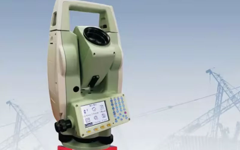
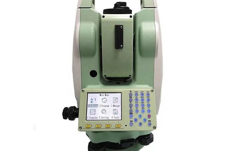
SUNWAY ATS-120A Total Station
The SUNWAY ATS-120A is a 2″ accuracy total station designed for general surveying, construction and engineering applications. It combines absolute angle encoding, a 30× telescope, reflector and reflectorless EDM, dual-axis compensation and practical field surveying software in a compact conventional total station.
The ATS-120A supports functions such as surveying, stakeout, resection, area and volume calculation, road surveying and reference line or arc operations. Its color TFT display, laser pointing, Bluetooth communication and multiple data transfer interfaces are designed to make routine field work more convenient. RTKSurvey.com supplies the SUNWAY ATS-120A for surveying contractors, engineering teams and surveying equipment distributors.
Key Features
2″ angle measurement accuracy with 1″ minimum readout
30× telescope for general surveying and construction work
Reflector and reflectorless distance measurement
Up to 4000–5000 m single-prism measurement under stated conditions
Reflectorless measurement available in different range configurations
Dual-axis automatic compensation
Laser pointing and laser plummet for easier targeting and setup
320 × 240 true-color TFT display
Built-in surveying, stakeout, resection, area and volume functions
Road and reference line/arc surveying programs
Bluetooth for wireless data transfer
RS232, Mini-B USB and USB storage interfaces
Multi-language operation support
Why Choose the SUNWAY ATS-120A?
The SUNWAY ATS-120A offers a practical combination of angle accuracy, distance measurement and field surveying functions for projects that do not require a robotic total station. Its reflectorless EDM can help surveyors measure selected points without placing a prism directly on the target, while the dual-axis compensator supports efficient instrument setup and routine field operation.
The straightforward software structure and familiar surveying workflows make the ATS-120A suitable for teams performing boundary, topographic, construction and engineering measurements. With Bluetooth, USB and SD card data options, it also provides flexible ways to transfer and manage survey data in the field.
Core Specifications
Model: ATS-120A
Angle Measurement Method: Absolute encoding
Angle Accuracy: 2″
Minimum Angle Readout: 1″
Telescope Magnification: 30×
Field of View: 1°30′
Minimum Focusing Distance: 1.5 m
Compensator: Dual-axis
Compensator Working Range: ±3″
Compensator Accuracy: 1″
Single-Prism Range: 4000–5000 m under stated conditions
Reflective Sheet Range: 1000 m
Distance Accuracy with Reflector: 2 mm + 2 ppm
Reflectorless Range: 400 / 600 / 800 / 1000 m configurations
Reflectorless Accuracy: 3 mm + 2 ppm
Reflectorless Measuring Time: Approx. 1.5 s
Display: 320 × 240 true-color TFT
Internal Data Memory: Approx. 20,000 points
Interfaces: RS232, Mini-B USB, USB storage
Wireless Communication: Bluetooth
Laser Plummet: Laser point; optical plummet optional
Centering Accuracy: 1 mm at 1.5 m instrument height
Operating Temperature: -20°C to +50°C
Protection: IP55
Battery: Li-ion, 7.4 V / 3000 mAh
Operating Time: Up to 16 hours under stated test conditions
Applications
Topographic surveying
Construction surveying
Engineering surveying
Boundary and cadastral surveying
Road surveying
Building layout
Stakeout
Area and volume measurement
Resection
Reference line and arc surveying
General land surveying



