Welcome to RTKSurvey.com

GNSS RTK Receiver Price: What Affects the Cost?
If you are comparing GNSS RTK receiver prices, you may notice that two systems with similar advertised positioning accuracy can have very different quotations.
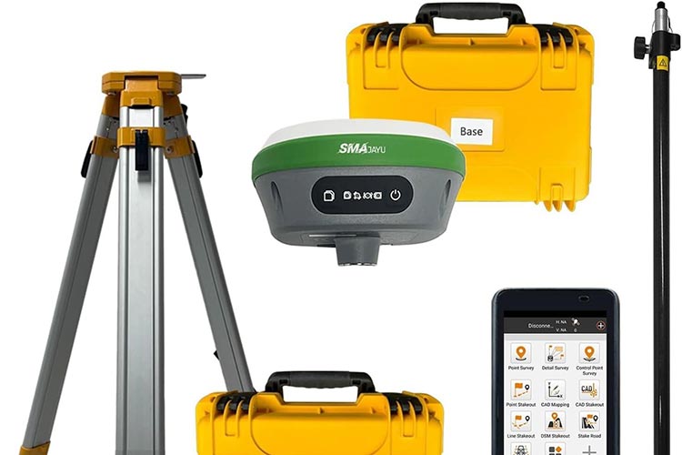
One supplier may offer a single RTK rover, while another quotes a complete base-and-rover package with a field controller, software and accessories. Advanced functions such as IMU tilt compensation, visual stakeout and laser measurement can also affect the price.
For surveying companies, construction contractors and equipment distributors, the important question is not simply how much an RTK receiver costs. It is how much a complete, usable surveying system costs for the intended work.
This guide explains the main price factors, common purchasing configurations and practical ways to compare GNSS equipment quotations.
How Much Does a GNSS RTK Receiver Cost?
Professional GNSS RTK equipment is available across a wide price range, from relatively economical network RTK rovers to higher-priced multifunction receivers and complete surveying packages.
There is no single representative price because quotations can refer to very different products and configurations.
For example, an advertised price may cover:
A GNSS receiver without a controller
One rover with surveying software
A base-and-rover pair
A complete field kit with poles, tripod and radio accessories
An advanced receiver with laser or visual surveying functions
A lower advertised price does not necessarily mean a lower total purchase cost.
Before comparing prices, ask whether each quotation covers the same equipment and software.
Base and Rover vs Network RTK: The Biggest Cost Decision
The correction method is often one of the first decisions affecting the total equipment budget.
Network RTK Rover
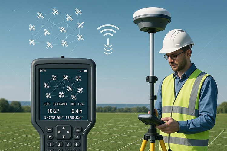
Where a reliable CORS or network RTK service is available, a surveyor may be able to work with one GNSS rover and a compatible controller.
Corrections are commonly received over a mobile internet connection using NTRIP.
This approach can reduce the initial hardware requirement because the surveyor does not need to purchase and deploy a local base station.
However, the total cost may include a correction-service subscription, cellular data and any required software licenses.
Local Base and Rover
A local base-and-rover setup uses a reference receiver at a known or appropriately established position to provide correction data to the rover.
This configuration normally requires more equipment, including a second receiver and suitable communication hardware.
It can be particularly useful for projects where network RTK coverage is unavailable or unreliable.
A local base does not automatically guarantee better coordinates. Correct base positioning, compatible correction settings and field verification remain essential.
For more technical background, read our GNSS RTK Base and Rover Setup Guide.
2. Receiver Features That Affect the Price
Two receivers may both advertise centimeter-level RTK positioning, but their capabilities can differ substantially.
GNSS Tracking and Signal Support
Modern receivers can track multiple satellite constellations and frequency bands.
The quality of the GNSS engine, antenna design and supported signals can influence positioning reliability under different conditions.
A larger advertised channel count alone does not prove that a receiver will perform better in every surveying environment.
IMU Tilt Compensation
IMU tilt compensation allows suitable measurements to be collected without keeping the survey pole perfectly vertical, within the instrument's supported operating conditions.
This can improve convenience around walls, corners and obstacles.
For crews performing frequent detail surveys or construction stakeout, tilt compensation may provide useful productivity benefits.
Visual and Laser Surveying
Some advanced GNSS receivers offer cameras, visual stakeout or laser-based measurement functions.
These features can support workflows where the surveyor needs to identify design points visually or measure certain inaccessible locations.
They may also increase the equipment price.
Buyers should evaluate whether these functions solve a real field problem rather than selecting the most feature-rich receiver by default.
Communication and Durability
Integrated UHF radio, cellular connectivity, environmental protection and battery performance can also influence the quotation.
Confirm the supported communication methods and regional radio configurations before ordering.
3. Controller and Survey Software Costs
The GNSS receiver is only one part of a working survey system.
A field controller is used to configure measurements, manage coordinate systems, collect points and perform stakeout.
Some equipment packages include a compatible controller and field software. Others offer them separately.
Before accepting a quotation, confirm:
Whether a field controller is included
Which surveying software is supplied
Whether the license is permanent or subscription-based
Whether required stakeout and coordinate transformation functions are available
Whether software updates or additional modules involve extra charges
A low receiver price can become less attractive if essential software must be purchased separately.
4. Accessories, Shipping and After-Sales Support
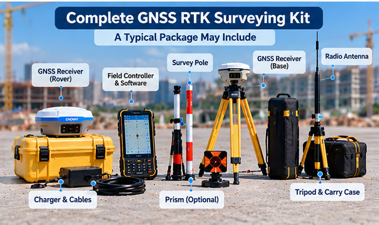
Small items can create meaningful differences between two quotations.
Depending on the configuration, a complete package may require a GNSS survey pole, tripod, tribrach, controller bracket, communication antenna, cables and charging accessories.
For international orders, also consider freight, import duties, local taxes and any applicable customs requirements.
After-sales support matters as well.
A receiver that is difficult to configure or incompatible with the customer's existing software may create costs through lost field time, even if its purchase price is lower.
For distributors, it is also worth confirming warranty procedures, spare-part availability and technical support arrangements before placing a larger order.
Case Study: Comparing Two RTK Purchasing Options
Illustrative procurement scenario, not an actual customer transaction.
A surveying contractor is preparing to equip two field crews.
Most projects are located in urban areas with dependable network RTK coverage, but the company also undertakes occasional work in remote locations.
The contractor considers two options.
Option A: Two Network RTK Rovers
Each crew receives a rover and compatible controller. Both crews use an available correction network.
This reduces the number of receivers the company needs to purchase initially.
However, the contractor must confirm network coverage, subscription costs and cellular reliability at its regular project sites.
Option B: A Local Base-and-Rover Package
The company purchases equipment capable of establishing its own local RTK correction source.
This offers more independence from commercial correction networks but increases the initial hardware requirement and base setup responsibilities.
The contractor also needs to consider whether one shared base can practically support both crews at their usual project locations.
Purchasing conclusion: If most work is inside dependable CORS coverage, network RTK may provide better initial value. If remote projects are frequent, investing in local base capability may be more practical.
The correct choice depends on project locations, crew deployment and long-term operating costs.
How to Compare GNSS RTK Quotations
When requesting prices from multiple suppliers, use the same equipment requirements for each quotation.
A useful comparison should identify:
| Item | What to Confirm |
|---|---|
| GNSS receiver | Brand, model, quantity and configuration |
| Correction method | NTRIP, UHF or both |
| Base station | Included or purchased separately |
| Controller | Model and compatibility |
| Survey software | Included functions and license terms |
| Accessories | Poles, tripods, brackets and communication equipment |
| Support | Warranty and technical assistance |
| Delivery | Freight, lead time and commercial terms |
Ask suppliers to identify optional items separately.
This makes it easier to understand whether a price difference comes from the receiver itself or from the equipment included in the package.
Buying GNSS RTK Receivers from China
China offers a wide selection of professional GNSS surveying equipment, including products from Hi-Target, CHCNAV, ComNav, SOUTH, KOLIDA and other established brands.
International buyers may compare these brands based on positioning functions, controller compatibility, communication methods and price.
However, comparing brands by price alone can be misleading.
A distributor purchasing for several markets may need different radio configurations, software languages and correction-network compatibility.
A construction company purchasing for one project may prioritize fast setup and straightforward operation.
RTKSurvey.com is a China-based surveying equipment supplier, not a GNSS receiver manufacturer. We supply products from multiple brands and help international buyers compare suitable equipment configurations.
Explore our GNSS Receivers category or read our China GNSS RTK Receiver Suppliers Guide for additional sourcing considerations.
Frequently Asked Questions
Why are GNSS RTK receiver prices so different?
Prices vary according to brand, hardware functions, communication options, software, accessories, warranty and the overall package configuration. A receiver-only quotation should not be compared directly with a complete field kit.
Is a base station necessary for RTK surveying?
Not always. A rover can use a compatible network RTK correction service where suitable coverage is available. A local base station is useful when the project requires an independent correction source.
Is a more expensive GNSS receiver always more accurate?
No. A higher price may reflect advanced features, software or support rather than better positioning results in every environment. Accuracy also depends on correction quality, satellite visibility, setup and survey procedures.
Does an RTK receiver price include surveying software?
It depends on the supplier and equipment package. Buyers should confirm software inclusion, supported functions and license terms before purchasing.
What information should I provide to request an RTK quotation?
Provide the intended application, project country, required number of receivers, correction method, controller requirements and any preferred brands. These details help the supplier prepare a more relevant equipment quotation.
Get a GNSS RTK Receiver Quotation
The best GNSS RTK receiver price is not necessarily the lowest advertised number. It is the cost of a system that includes the equipment, software and support needed to complete your surveying work.
Before purchasing, compare complete configurations and consider both initial investment and ongoing operating expenses.
RTKSurvey.com supplies GNSS RTK receivers and surveying accessories for professional buyers worldwide.
Browse our GNSS Receivers or contact us with your project requirements to request a quotation.