Welcome to RTKSurvey.com

How to Choose a GNSS RTK Receiver for Surveying
Choosing a GNSS RTK receiver is not simply a matter of buying the model with the highest channel count or the longest feature list. The right equipment depends on where you survey, how you receive corrections, which field software you use, and what your team needs to measure.
For surveying contractors, engineering companies and equipment distributors, a poor equipment match can lead to additional setup time, incompatible accessories or unnecessary purchasing costs.
This guide explains how to choose a GNSS RTK receiver based on actual field requirements, with practical examples and a checklist for comparing equipment before ordering.
1. Start with Your Surveying Applications
Before comparing brands, identify the work the receiver will perform most often.
Land and Topographic Surveying
For general land surveying, terrain mapping and point collection, prioritize reliable RTK positioning, convenient field software and manageable equipment weight.
A receiver with IMU tilt compensation can also improve productivity when collecting points along slopes, roadsides and other locations where keeping the pole vertical is inconvenient.
Construction Stakeout
Construction teams often need to locate design points, verify elevations and work with project coordinate systems.
In this case, the field controller and software deserve as much attention as the receiver itself. Check coordinate transformation functions, CAD file support, stakeout workflows and data export options.
Remote Infrastructure Projects
Road construction, pipelines and other infrastructure projects may extend beyond dependable cellular coverage.
For these applications, a GNSS receiver with compatible UHF radio functions and a suitable base-and-rover configuration may be more practical than relying exclusively on network RTK.
Surveying Equipment Distribution
Distributors should consider a wider range of customer requirements.
A receiver that works well with one correction network or controller may not be suitable for every market. Before selecting models for resale, verify regional radio requirements, software language options, accessories and technical support.
2. Choose the Right RTK Correction Method
One of the most important purchasing decisions is how the rover will receive correction data.
| Requirement | Network RTK (NTRIP) | Local Base and Rover |
|---|---|---|
| Correction source | Reference station network | Locally established base |
| Main communication | Internet connection | Typically UHF radio |
| Additional equipment | Compatible receiver and internet access | Base receiver and communication equipment |
| Best suited to | Areas with reliable network service | Projects without suitable network coverage |
| Important checks | Network access, format and coverage | Radio compatibility, base coordinates and range |
When Network RTK Makes Sense
Network RTK can simplify field setup when a suitable correction service is available.
Before purchasing, confirm that the receiver and controller can connect to the intended NTRIP service. Ask about correction formats, network subscriptions, cellular connectivity and local coverage.
When a Base-and-Rover System Is Better
A local base-and-rover system gives the survey team more control over its correction source.
However, it also requires appropriate base coordinates, a suitable installation location and a reliable communication link. Radio coverage depends on terrain, obstructions, antennas, transmit power and local regulations.
For a more detailed explanation, read our GNSS RTK Base and Rover Setup Guide.
Buying tip: Do not assume that every GNSS RTK receiver supports both base and rover functions. Verify the operating modes of the specific model.
3. Evaluate GNSS Tracking and Positioning Performance
Modern survey receivers commonly support multiple satellite constellations, including GPS, BeiDou, Galileo and GLONASS.
Multi-constellation tracking can improve satellite availability, particularly when part of the sky is obstructed.
However, a receiver advertising more GNSS channels is not automatically more accurate than another model.
When comparing specifications, consider:
Supported satellite constellations and signals
Published horizontal and vertical RTK accuracy
Initialization and reinitialization performance
Receiver and antenna design
Performance under partial obstructions
Compatibility with available corrections
Published accuracy specifications are generally based on defined test conditions. Actual field results can differ because of multipath, satellite geometry, correction quality and measurement procedures.
For critical work, verify positions against known control points rather than relying only on an RTK Fixed indicator.
4. Decide Whether You Need IMU Tilt Compensation
IMU tilt compensation is a useful feature for many modern surveying workflows.
It allows supported receivers to estimate the position of the pole tip while the pole is tilted, within the instrument's operating limits.
This can be particularly helpful when measuring:
Building corners
Road edges and curbs
Fence lines
Points beside walls or obstacles
Uneven ground where vertical pole positioning is difficult
Not all tilt systems perform the same way. Some require initialization movements, while others are designed for calibration-free operation.
Compare the manufacturer's stated tilt accuracy, supported angle, initialization procedure and operating limitations.
Important: IMU tilt compensation does not solve poor satellite reception. A tilted measurement still depends on valid GNSS positioning and correct pole-height settings.
If your team normally works in open areas with easily accessible points, an advanced tilt system may be convenient rather than essential.
5. Check Field Controller and Software Compatibility
A GNSS RTK receiver is only one part of a complete surveying system.
The controller and field software determine how efficiently your team can create projects, collect points, stake out designs and export results.
Before ordering, ask these questions:
Does the software support the coordinate systems and transformations used in your projects?
Can it import the CAD or design files your team receives?
Which export formats are available for office processing?
Does it support the required stakeout and data collection functions?
Can it connect to your intended NTRIP service or radio equipment?
Is technical assistance available for software setup and troubleshooting?
For companies replacing existing equipment, controller compatibility can be a deciding factor.
Do not assume that a controller from one brand will operate another brand's receiver with full functionality. Basic communication and advanced feature support may differ.
6. Consider Battery Life, Durability and Portability
Survey crews may spend an entire working day away from charging facilities.
When comparing receivers, check the operating time for the intended mode rather than relying on a single advertised battery figure.
Radio transmission, cellular communication, screen use and environmental conditions can affect power consumption.
Other practical considerations include:
Receiver weight when mounted on a pole
Charging connector and power-bank compatibility
Dust and water protection
Operating temperature range
Resistance to everyday field handling
Availability of replacement accessories
For remote projects, a dependable charging arrangement may be more useful than a small difference in receiver weight or battery capacity.
7. Do You Need Laser, Camera or Visual Surveying Features?
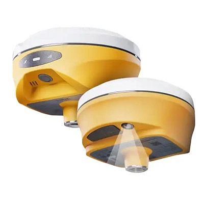
Some newer GNSS RTK receivers include laser measurement, cameras or visual stakeout functions.
These features can be useful when the operator cannot safely or conveniently place the pole directly on the target point.
Examples include certain building corners, roadside features and other difficult-to-access locations.
However, additional technology also increases the importance of checking software support, measurement limitations and the training required for field operators.
A conventional GNSS RTK receiver may remain the better value for teams primarily collecting accessible ground points.
When comparing advanced models, request a demonstration using the same type of task your team performs in the field.
8. Match the Receiver to Your Project
The following examples illustrate how different requirements lead to different purchasing decisions. They are hypothetical scenarios, not customer case studies.
Example A: Small Land Surveying Team
A three-person team performs topographic surveys and construction layout in an area with reliable cellular coverage.
Suggested priorities: A compact multi-constellation rover, compatible NTRIP support, reliable field software and practical IMU tilt compensation.
A dedicated base station may not be necessary if the team has dependable access to an appropriate correction network.
Example B: Road Project in a Remote Region
A contractor is surveying a long road corridor where cellular service is inconsistent.
Suggested priorities: Base-and-rover capability, compatible UHF communication, suitable power arrangements and dependable controller software.
Before buying, the contractor should assess radio coverage along the corridor and establish how base coordinates will be determined.
Example C: Surveying Equipment Distributor
A distributor wants to offer GNSS receivers to customers with different budgets and field requirements.
Suggested priorities: A manageable selection of entry-level and advanced models, clear accessory configurations, software compatibility, regional radio compliance and dependable supplier support.
Rather than stocking every available feature combination, the distributor can organize its product range around common customer applications.
9. Compare Complete RTK Systems, Not Just Receiver Prices
Two receivers with similar positioning specifications may have different total purchasing costs.
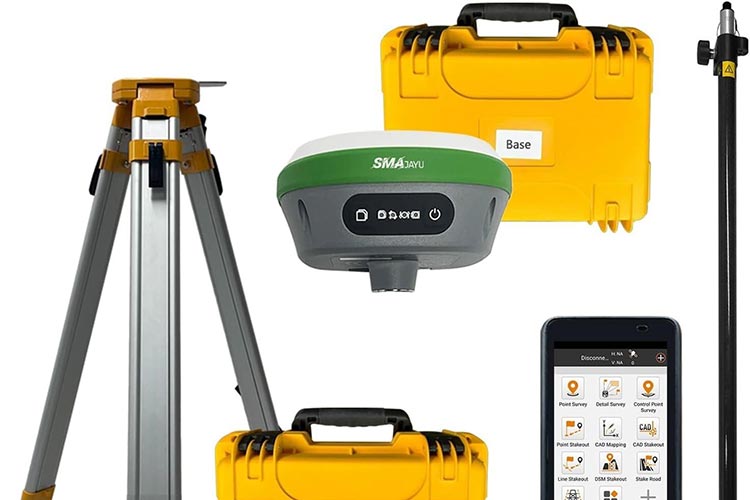
A quotation may or may not include the field controller, surveying software, radio accessories, poles, chargers, carrying cases or other components.
Before comparing offers, confirm exactly what is included.
| Item | What to Verify |
|---|---|
| GNSS receiver | Model and enabled functions |
| Field controller | Model, software and license |
| Correction system | NTRIP, UHF or both |
| Base equipment | Included or purchased separately |
| Accessories | Pole, mounts, charger and case |
| Support | Warranty, setup help and service terms |
| Delivery | Shipping arrangement and lead time |
A lower receiver-only price does not necessarily mean a lower cost for a working surveying system.
For more information, see our GNSS RTK Receiver Price Guide.
10. GNSS RTK Receiver Buying Checklist
Before confirming a purchase, review these points:
Identify the main surveying applications.
Confirm project accuracy and quality-control requirements.
Check local GNSS correction availability.
Decide whether a base station is required.
Verify NTRIP and UHF compatibility.
Review field controller and software functions.
Decide whether IMU tilt compensation is necessary.
Check battery life and environmental protection.
Confirm all included accessories.
Verify warranty and technical support.
Request a complete quotation for the required configuration.
For international buyers, it is also useful to confirm regional radio-frequency requirements and whether the selected configuration is suitable for the destination country.
Frequently Asked Questions
What Is the Best GNSS RTK Receiver for Surveying?
There is no single best receiver for every surveying project. The right choice depends on correction availability, field conditions, software requirements, accuracy needs and budget.
Is a Higher GNSS Channel Count Always Better?
No. Channel count is only one specification. Satellite signal support, receiver processing, antenna quality and correction reliability are also important.
Do I Need a Base Station for My RTK Receiver?
Not always. A rover can use a compatible network RTK service where suitable coverage is available. A local base may be required or preferred for projects without reliable network corrections.
Is IMU Tilt Compensation Worth Paying For?
It can improve productivity when surveyors frequently measure points that are difficult to access with a vertical pole. For simple open-sky work, the benefit depends on the team's workflow.
Can Different GNSS RTK Brands Work Together?
Some receivers and controllers can exchange compatible correction data or use shared communication standards. However, full interoperability should never be assumed without checking formats, radio protocols, software and feature support.
Should I Choose GNSS RTK or a Total Station?
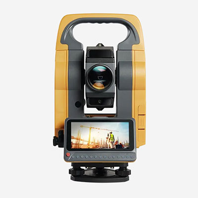
GNSS RTK is efficient for many outdoor surveying tasks, while total stations remain important where satellite visibility is restricted or project measurement requirements favor optical methods.
Read our GNSS RTK vs Total Station Comparison for more details.
Find a GNSS RTK Receiver for Your Surveying Projects
Selecting the right GNSS RTK receiver starts with understanding the complete surveying workflow, not simply comparing headline specifications.
A receiver that fits your correction method, controller software and field environment can provide better practical value than a more expensive model with features your team rarely uses.
RTKSurvey.com is a multi-brand surveying equipment supplier offering GNSS RTK receivers and related field equipment for international buyers.
Explore our GNSS Receivers category to compare available brands and models.
If you are sourcing equipment for a surveying company, construction project or distribution business, contact RTKSurvey.com with your application, correction method, destination country and required accessories to discuss suitable equipment configurations.