Welcome to RTKSurvey.com

GNSS RTK vs PPK: Which Is Better for Surveying?
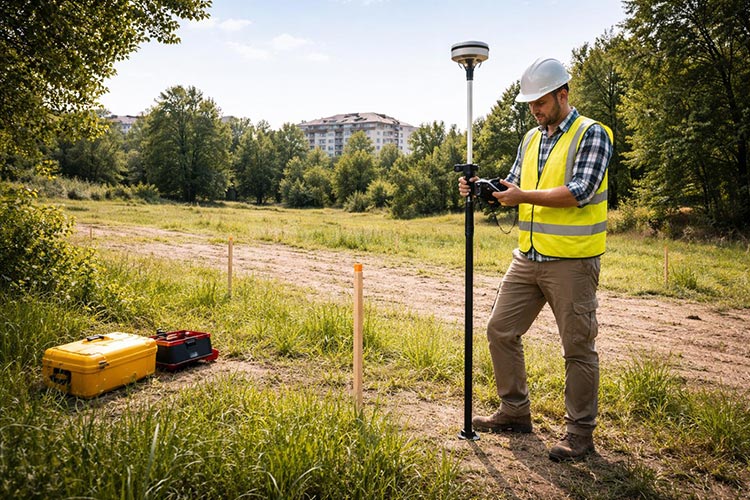
GNSS RTK and PPK are two widely used positioning methods in professional surveying. Both use satellite observations and correction data to achieve precise positioning, but they differ in how and when the results are calculated.
RTK (Real-Time Kinematic) provides positioning results in the field, while PPK (Post-Processed Kinematic) calculates corrected positions after data collection.
For surveyors, construction contractors, drone mapping operators and surveying equipment buyers, choosing between RTK and PPK affects field efficiency, communication requirements, data processing and equipment configuration.
This guide compares RTK and PPK, explains where each method works best, and highlights what to check before purchasing GNSS equipment.
1. What Is GNSS RTK?
Real-Time Kinematic (RTK) is a GNSS positioning technique that uses correction information from a reference station or reference network to improve positioning accuracy in real time.
A typical RTK setup includes a rover receiver, a correction source and a communication link.
Corrections may be delivered through a local UHF radio connection or an internet-based NTRIP service.
When the receiver has suitable satellite observations and successfully resolves the carrier-phase ambiguities, it can provide centimeter-level positioning under appropriate conditions.
How RTK Works in the Field
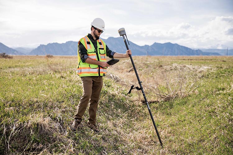
During an RTK survey, the rover receives satellite signals and correction data while the surveyor collects points or performs stakeout.
The field controller displays the current position and positioning status, allowing the operator to make decisions immediately.
This makes RTK particularly useful for topographic surveys, construction layout and other projects requiring real-time coordinates.
However, RTK performance depends on reliable correction delivery, satellite visibility, suitable observation conditions and correct survey procedures.
For a detailed introduction, read our What Is an RTK GNSS Receiver? guide.
2. What Is GNSS PPK?
Post-Processed Kinematic (PPK) is a GNSS positioning technique that processes satellite observation data after field measurements have been completed.
Instead of requiring real-time correction delivery, PPK uses recorded GNSS observations from the moving receiver and an appropriate reference station or reference network.
Specialized processing software combines the observation data to calculate corrected positions.
How PPK Works
A typical PPK workflow involves:
Recording GNSS observation data with the rover or mobile platform.
Obtaining corresponding observation data from a suitable reference station.
Transferring the recorded data to processing software.
Processing the observations and reviewing positioning quality.
Exporting the corrected coordinates or trajectory for further surveying work.
PPK can be useful where real-time communication is unreliable or where positioning results do not need to be available immediately.
However, PPK still requires adequate satellite observations, suitable reference data and correct processing procedures.
It is not a guaranteed solution for poor GNSS signal reception.
3. GNSS RTK vs PPK: Key Differences
Although both methods use carrier-phase GNSS observations, their operational requirements are different.
| Feature | GNSS RTK | GNSS PPK |
|---|---|---|
| Position calculation | During field measurement | After data collection |
| Correction delivery | Real-time communication required | Recorded reference data used later |
| Immediate coordinates | Yes | Not necessarily |
| Field stakeout | Suitable | Not suitable as a standalone real-time method |
| Internet or radio connection | Required for correction delivery | Not required during data collection |
| Post-processing | Usually not required for standard RTK output | Required |
| Typical applications | Land surveying, construction stakeout, point collection | Drone mapping, trajectory processing, remote data collection |
| Main consideration | Reliable real-time correction link | Complete observation data and processing workflow |
Is PPK More Accurate Than RTK?
Neither method is automatically more accurate in every situation.
Both can achieve centimeter-level positioning under suitable conditions, depending on equipment, observation quality, baseline length, processing methods and project requirements.
PPK may offer advantages when real-time communication is interrupted or when recorded observations can be processed more carefully afterward.
However, post-processing cannot always recover reliable positions from severely obstructed or poor-quality satellite observations.
The correct choice depends on the required deliverables and the conditions under which the measurements are collected.
4. When Should You Choose RTK?
RTK is generally the preferred method when surveyors need accurate coordinates immediately.
Land and Topographic Surveying
For boundary-related fieldwork, terrain surveys and point collection, RTK allows operators to review coordinates as measurements are taken.
Surveyors can identify missing points, repeat questionable observations and complete much of the fieldwork without a separate post-processing stage.
Construction Stakeout
Construction projects often require surveyors to locate design points and verify positions directly on site.
RTK provides the real-time feedback necessary for these tasks.
PPK alone cannot replace this workflow because the corrected coordinates are calculated after the observations are collected.
Utility and Infrastructure Surveys
For roads, pipelines and utility projects, RTK can be efficient when the correction link remains dependable.
Where cellular coverage is limited, a compatible base-and-rover radio setup may be an option.
Learn more in our GNSS RTK Base and Rover Setup Guide.
5. When Is PPK a Better Choice?
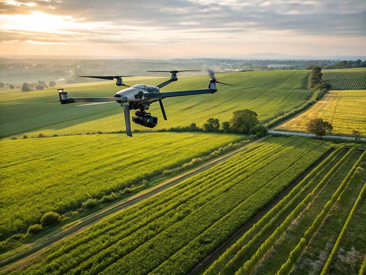
PPK is particularly valuable when recording accurate GNSS data is possible but maintaining a real-time correction connection is difficult or unnecessary.
Drone Mapping and Aerial Surveying
PPK is widely used in professional drone mapping workflows.
A drone equipped with a suitable GNSS system can record observation data during a flight. Afterward, the flight data can be processed using corresponding reference station observations.
The resulting positioning information may be used to improve the georeferencing of aerial images or other survey data.
However, final mapping accuracy also depends on camera calibration, image quality, processing methods, control points and the overall survey design.
PPK does not automatically eliminate the need for ground control or independent checkpoints.
Remote Surveying Areas
In locations without dependable mobile coverage or practical radio correction links, PPK can reduce the need for continuous communication during data collection.
The operator still needs a suitable reference data source and must verify that the equipment records the observations required for processing.
Mobile Mapping and Trajectory Processing
Some mobile mapping systems use GNSS observation logging and post-processing to calculate or refine trajectories.
These systems may also integrate inertial navigation sensors to maintain trajectory continuity during short GNSS interruptions.
The final result depends on the complete sensor system and processing workflow, not on PPK alone.
6. Can You Use RTK and PPK Together?
Yes. Some professional GNSS workflows use RTK for immediate positioning and record raw observations for later processing.
This can provide additional flexibility when field conditions change.
For example, a survey team may use RTK while corrections are available and record GNSS observations for later analysis when communication becomes unreliable.
However, this workflow is possible only when the receiver, software and data configuration support the required functions.
Not every RTK receiver supports raw observation logging or the same post-processing formats.
Before purchasing, confirm whether the specific receiver supports the intended RTK and PPK workflow.
7. What Equipment Do You Need for RTK and PPK?
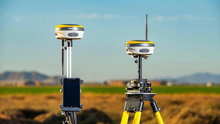
The equipment requirements overlap, but the complete system configuration can differ.
Equipment for RTK Surveying
A typical RTK configuration may include:
Multi-constellation GNSS rover receiver
Compatible correction source
Field controller and surveying software
Cellular or UHF communication equipment
Survey pole, mounting accessories and power supply
A local base receiver may also be required if a suitable correction network is unavailable.
Equipment for PPK Surveying
A PPK workflow may require:
GNSS equipment capable of recording suitable raw observations
Reference station observation data
Compatible post-processing software
Data transfer and storage arrangements
Appropriate coordinate reference and quality-control procedures
For drone mapping, additional requirements may include accurate image-event timing, camera synchronization and compatible photogrammetry software.
Buying tip: A receiver advertised as RTK-capable is not necessarily PPK-ready. Confirm raw data recording, export formats, observation logging settings and processing software compatibility before ordering.
8. Practical Surveying Scenarios
The following examples are illustrative project scenarios rather than reports of completed customer projects.
Scenario A: Construction Site with Reliable Network Coverage
A contractor needs to stake out foundation points and check completed construction positions.
Recommended approach: RTK.
The team needs real-time coordinates and immediate field feedback. A compatible network RTK rover may provide an efficient setup if correction coverage is reliable.
Scenario B: Drone Survey in a Remote Agricultural Area
A mapping company plans an aerial survey where continuous cellular service is unavailable.
Recommended approach: Consider PPK.
If the drone records suitable GNSS observations and corresponding reference data is available, the team can process positioning information after the flight.
Independent checkpoints should still be used to assess the accuracy of the mapping deliverables.
Scenario C: Infrastructure Survey with Intermittent Corrections
A survey crew is collecting data along a long corridor where radio or cellular correction delivery is inconsistent.
Recommended approach: Evaluate a combined RTK and observation-logging workflow.
RTK may be used where real-time corrections are available, while supported raw observation recording provides additional processing options.
The team should verify receiver capabilities and establish its processing procedure before starting the project.
9. How to Choose Between RTK and PPK
The best method depends on the project workflow rather than a single accuracy specification.
Start by answering these questions:
Do you need coordinates immediately? Choose RTK when real-time stakeout or field decisions are essential.
Is correction communication reliable? PPK may be useful when continuous real-time corrections are impractical.
Are you surveying with a drone? Evaluate the aircraft's RTK and PPK capabilities together with its mapping software.
Can your equipment record raw observations? Confirm this before planning a PPK workflow.
Do you have suitable reference data? Both methods depend on an appropriate correction or reference source.
Can your team manage post-processing? PPK requires additional processing and quality-control procedures.
For many conventional land surveying projects, RTK remains the more convenient primary workflow.
For drone mapping and certain remote or mobile surveying applications, PPK can be an important alternative or complementary method.
If you are comparing receiver features, see our How to Choose a GNSS RTK Receiver for Surveying guide.
Frequently Asked Questions
What Is the Main Difference Between RTK and PPK?
RTK calculates corrected positions during field measurement using real-time correction data. PPK processes recorded GNSS observations after data collection.
Does PPK Need an Internet Connection?
PPK does not require a continuous internet connection during field data collection. However, internet access may be needed later to download reference observations or transfer data.
Can PPK Achieve Centimeter-Level Accuracy?
Yes, under suitable conditions. Actual accuracy depends on observation quality, reference data, equipment, processing methods and project conditions.
Is RTK or PPK Better for Drone Mapping?
Both methods can support accurate drone mapping. RTK provides corrected positioning during flight, while PPK processes recorded observations afterward. The better choice depends on correction availability, equipment compatibility and the mapping workflow.
Can Every RTK GNSS Receiver Be Used for PPK?
No. PPK requires suitable observation recording and compatible processing tools. These functions must be verified for the specific receiver and software.
Can PPK Replace a Total Station?
Not in every application. PPK does not provide the immediate field measurements needed for many construction layout tasks, and GNSS methods remain limited in environments with poor satellite visibility.
Find GNSS Equipment for RTK and PPK Surveying
RTK and PPK are complementary positioning methods with different operational advantages.
RTK is particularly effective when surveyors need immediate coordinates, while PPK provides a useful option for processing recorded observations when real-time corrections are unavailable or unnecessary.
For equipment buyers, the most important step is to match the GNSS receiver, correction method, data logging functions and software to the intended project.
RTKSurvey.com supplies multi-brand surveying equipment for international customers, including GNSS RTK receivers, field controllers and related accessories.
Explore our GNSS Receivers category to review available equipment.
If you need help selecting a configuration for land surveying, infrastructure projects or drone mapping, contact RTKSurvey.com with your application, destination country and required positioning workflow.