Welcome to RTKSurvey.com

RTK GNSS vs Total Station for Construction Layout: Accuracy and Field Checks
A surveyor can stake out an earthwork boundary with RTK GNSS in minutes, but should the same equipment be used to position steel columns or anchor bolts?
The answer depends on the construction tolerance, site conditions and how the measurements will be checked.
RTK GNSS and total stations are both widely used for construction layout. However, selecting equipment based only on the accuracy printed in a datasheet can lead to costly mistakes.
This guide explains how to choose between RTK GNSS and a total station for different construction tasks, with practical examples and field verification procedures.
Quick Answer: Which Is Better for Construction Layout?
RTK GNSS is often the more efficient choice for open-site earthworks, general grading and preliminary construction stakeout. A properly controlled total station is generally better suited to building grids, structural positioning and layout tasks with tighter local tolerances.
For demanding elevation work, a level may also be required.
The correct method depends on the project's specified tolerances, control network and verified field performance—not simply the instrument's advertised accuracy.
1. Start with Construction Tolerances, Not Instrument Specifications
Before selecting surveying equipment, determine what the construction team actually needs to position.
For example, marking the approximate boundary of an excavation is very different from setting out an anchor bolt group.
Both are construction layout tasks, but their acceptable positional errors may differ substantially.
Three requirements should be considered:
Horizontal tolerance: How far can the constructed position deviate from the design location?
Vertical tolerance: How much elevation difference is permitted?
Relative accuracy: How precisely must nearby structural elements align with one another?
A GNSS receiver may produce a reliable centimeter-level coordinate while still being unsuitable for a structural task requiring tighter relative positioning.
Likewise, a total station with excellent angular and distance specifications will not deliver reliable results if its station setup or project control is incorrect.
A Practical Equipment Selection Matrix
| Construction Task | Commonly Suitable Method | Main Consideration |
|---|---|---|
| Rough grading boundaries | RTK GNSS | Efficient coverage of open areas |
| General earthworks stakeout | RTK GNSS | Reliable corrections and project coordinates |
| Utility corridor layout | RTK GNSS or total station | Obstructions and specified tolerance |
| Building foundation corners | Total station often preferred | Local geometry and control quality |
| Structural column grids | Total station | Tight relative positioning |
| Anchor bolt positioning | Precision total station workflow | Structural tolerances and independent checks |
| Interior building layout | Total station | Limited satellite visibility |
| Precise elevation transfer | Digital or optical level | Vertical control and closure requirements |
This table is a general selection guide, not a universal construction tolerance standard. The approved project specification determines which method is acceptable.
2. When RTK GNSS Works Best for Construction Stakeout

RTK GNSS is particularly useful when a crew needs to cover a large outdoor construction site.
Typical applications include excavation boundaries, road corridors, earthwork limits, drainage alignments and preliminary utility locations.
Example: Earthworks on an Open Industrial Site
Consider a hypothetical 12-hectare industrial development.
Before foundation construction begins, the survey team must mark excavation limits, temporary access roads and grading boundaries.
The site has open sky visibility and reliable RTK corrections.
A GNSS rover allows the crew to move quickly between stakeout points without repeatedly relocating an optical instrument.
However, the team still checks established control points and confirms that the rover uses the correct project coordinate system.
The important distinction: RTK GNSS is efficient for this stage because its verified accuracy meets the specified requirements—not merely because it displays a fixed solution.
For additional field verification guidance, see GNSS RTK Check Shots: How to Verify Survey Accuracy.
3. When a Total Station Is the Better Choice
As construction progresses, the required positioning accuracy may become more demanding.
Foundation elements, column grids, structural interfaces and mechanical installations often depend on precise local geometry.
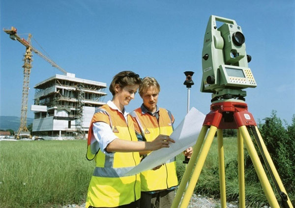
A total station measures angles and distances relative to established control and can be particularly effective for these tasks.
Example: Setting Out Structural Columns
Imagine a contractor preparing the column positions for a steel-frame building.
The approved layout requires consistent spacing and alignment between multiple columns.
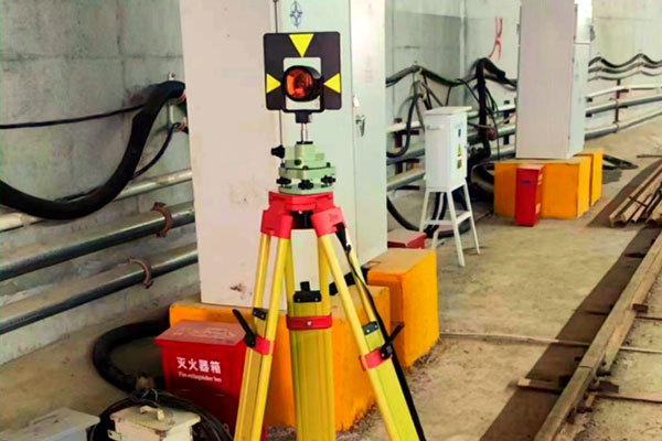
The surveyor establishes the total station on verified control, checks the backsight orientation and measures the required positions.
After staking, critical locations are checked using an independent observation or suitable control setup.
The crew does not rely solely on the total station's nominal instrument accuracy.
Instrument centering, prism configuration, control coordinates and measurement geometry all contribute to the final result.

Why Reflectorless Measurement Is Not Always the Best Option
Reflectorless measurement can be convenient for checking accessible surfaces, but the returned measurement may depend on surface reflectivity, angle and geometry.
For critical layout points, a properly configured prism-based workflow may provide a more clearly defined target.
Learn more in Reflectorless Total Station vs Prism: Which Is Better?.
4. The Hidden Problem: Grid Coordinates vs Ground Distances
A construction project may use a local engineering coordinate system, a projected grid or a site calibration.
These systems must be handled consistently when GNSS and total station measurements are combined.
For example, a GNSS rover may output projected grid coordinates while a total station measures physical ground distances.
Depending on the project coordinate system and scale factors, grid distances and ground distances may not be identical.
If the team ignores this difference, layout errors can increase with distance even when both instruments are functioning correctly.
Before construction stakeout, confirm:
Approved horizontal coordinate reference system
Project vertical datum
Grid-to-ground scale treatment, where applicable
Approved site calibration or localization
Coordinates of established control points
Instrument and field software settings
The correct procedure should be defined in the project survey control documentation.
5. A Combined RTK GNSS and Total Station Workflow
For many construction projects, using both technologies is more practical than forcing one instrument to perform every task.
A typical workflow may follow these stages.
Step 1: Establish and Verify Project Control
Use an appropriate control survey method, such as static GNSS or a terrestrial control network, according to the project requirements.
Check the coordinates and adjustment results before relying on them for layout.
RTK GNSS observations alone should not automatically be treated as sufficient for every class of primary control.
Step 2: Complete Open-Site Stakeout with RTK GNSS
Use the GNSS rover for suitable grading limits, earthwork boundaries and other layout tasks where verified RTK performance meets the required tolerances.
Carry out check shots on established control and investigate unexpected discrepancies.
Step 3: Transfer to Total Station Layout
As work approaches buildings, structural elements or obstructed locations, use verified project control to establish the total station.
Confirm the station setup, orientation and target configuration.
Step 4: Check Critical Layout Independently
Measure selected critical positions using a separate setup or another suitable verification procedure.
A repeat observation from the same incorrect setup may reproduce the same error, so independent checks are important.
Step 5: Document the Results
Record the control used, equipment settings, check observations, discrepancies and corrective actions.
For construction acceptance, follow the project's approved quality-control and survey documentation requirements.
6. Field Checklist Before Accepting Stakeout Points
A useful construction layout quality-control checklist includes:
Confirm that the latest approved design coordinates are being used.
Verify the horizontal and vertical reference systems.
Check at least the control required by the approved survey procedure.
Confirm GNSS correction status and measurement quality, where applicable.
Check total station orientation, centering and prism settings, where applicable.
Verify critical points independently.
Compare measured differences against the project's actual tolerances.
Document any discrepancy before the construction crew proceeds.
A successful instrument measurement is not automatically an accepted construction position.
7. What Surveying Equipment Should a Construction Contractor Buy?
The most suitable equipment depends on the contractor's project portfolio.
For earthworks and road preparation: A professional GNSS RTK Receiver can provide efficient outdoor stakeout when satellite visibility and correction coverage are suitable.
For building and structural construction: A Total Station is often essential for controlled layout, alignment and detailed measurement.
For companies handling both: A combined equipment setup may reduce workflow limitations and allow crews to select the most appropriate measurement method.
Before purchasing, evaluate instrument performance, field software compatibility, controller requirements, accessories and local service support.
RTKSurvey.com supplies multiple brands of surveying instruments, helping international buyers compare equipment options for their project requirements.
Frequently Asked Questions
Is RTK GNSS accurate enough for building foundations?
It may be suitable for some foundation layout tasks if verified accuracy meets the approved tolerance. For tighter structural positioning and relative geometry, a total station is often preferable.
Can RTK GNSS achieve millimeter accuracy for construction stakeout?
Conventional real-time RTK should not be assumed to provide reliable millimeter-level field positioning. Advertised precision, actual measurement uncertainty and project acceptance tolerances must be distinguished.
Why use a total station if GNSS RTK already provides coordinates?
A total station can support precise local geometry, work without satellite visibility at the measured point and provide an alternative measurement method for critical layout.
Should contractors use a digital level for elevation checks?
For tasks with demanding vertical tolerances, a digital or optical level may be more appropriate than relying on GNSS heights alone.
Final Thoughts
The decision between RTK GNSS and a total station for construction layout should begin with the required tolerance.
RTK GNSS offers speed and flexibility across suitable open construction sites. Total stations provide valuable precision and control for structural layout and obstructed environments.
For many contractors, the most reliable solution is a coordinated workflow that combines both methods with independent verification.
Explore GNSS Receivers and Total Stations at RTKSurvey.com, or contact our team to discuss equipment options for your construction projects.