Welcome to RTKSurvey.com

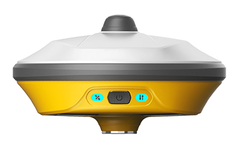

Unistrong eRTK10 eSurvey AR Visual Stakeout GNSS Receiver
The Unistrong eRTK10 is an AR visual stakeout GNSS receiver that combines RTK positioning, camera-based visual guidance and IMU tilt surveying in a compact field unit. Its visual system helps guide operators toward stakeout points in the real working environment, while the 60° tilt function allows measurements without conventional pole leveling. RTKSurvey.com supplies the eRTK10 for construction layout, surveying and other rover-based applications.
Key Features
• 1408-channel multi-constellation and multi-frequency GNSS tracking
• AR visual stakeout using a 2MP camera
• 88° camera field of view with approximately 3 cm stakeout accuracy
• 60° dynamic tilt surveying
• Built-in UHF receiver covering 410–470 MHz
• Web UI for setup, status monitoring, data management and firmware updates
• 8 GB internal memory
• IP67 field protection
Core Specifications
GNSS Channels: 1408
RTK Accuracy: H 8 mm + 1 ppm, V 15 mm + 1 ppm
Tilt Surveying: Up to 60°
Visual Camera: 2 MP
Camera FOV: 88°
Visual Stakeout Accuracy: Approx. 3 cm
Internal Radio: RX only
Radio Frequency: 410–470 MHz
Update Rate: 20 Hz
Internal Memory: 8 GB
Battery: 13600 mAh
Rover Working Time with Camera: Up to 21 hours
Weight: Approx. 891 g
Protection: IP67
Operating Temperature: -30°C to +60°C
Applications
• Construction stakeout
• Building and engineering layout
• Topographic surveying
• Road and infrastructure projects
• Point collection and field mapping
• General rover-based GNSS surveying
Related Products
• Unistrong E100 Network RTK Receiver
• Unistrong G980SE RTK GPS Receiver
• Unistrong G20 GPS RTK Receiver
• Unistrong G970II Pro GNSS RTK GPS Receiver



