Welcome to RTKSurvey.com

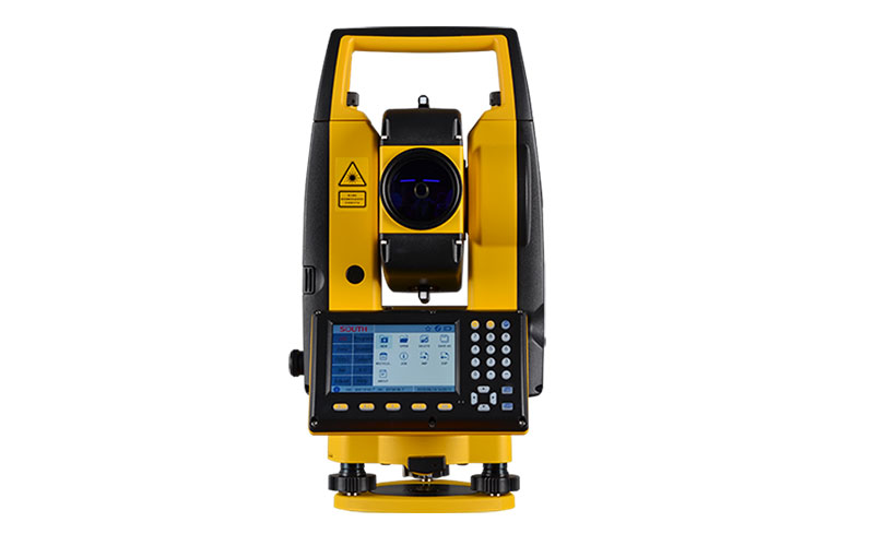
SOUTH N40 Series Graphic Total Station
The SOUTH N40 Series is a graphic total station designed for efficient engineering and construction surveying. It combines 1″ or 2″ angular accuracy with long-range EDM, a color touchscreen and practical onboard surveying functions.
The N40 Series provides prism measurement up to 5000 m and reflectorless measurement up to 1000 m. Its 4-inch color touchscreen presents more field information on one screen, while the dual-face display and physical numeric keys provide flexible operation in different working conditions.
The instrument also integrates features such as Guide Light, camera-assisted target aiming and Auto Instrument Height. Data can be transferred through internal memory, USB, Bluetooth or WLAN, giving survey teams several options for field data management.
Key Features
1″ and 2″ angular accuracy options
Prism measurement up to 5000 m
Reflectorless measurement up to 1000 m
Distance accuracy of 1 mm + 1 ppm or 2 mm + 2 ppm depending on model
4-inch color touchscreen
Dual-face display with backlight
Numeric keypad for field operation
Guide Light
Camera for target aiming and recording
Auto Instrument Height
Trigger key for quick measurement
USB, Bluetooth and WLAN data transfer
New-generation onboard surveying software
Why Choose the SOUTH N40 Series?
The N40 Series is positioned between traditional mechanical total stations and newer Android-oriented instruments. Its graphical interface makes field information easier to view, while the physical keypad retains the familiar control method preferred by many surveyors.
Its 5000 m prism range and 1000 m reflectorless capability provide flexibility across larger survey sites and areas where prism placement is difficult. Guide Light, camera functions and Auto Instrument Height can also reduce repetitive field operations.
For engineering and construction teams, the N40 Series offers a practical combination of precision, long-range EDM and graphical field operation.
Core Specifications
Model: SOUTH N40 Series
Type: Graphic Total Station
Angular Accuracy: 1″ / 2″
Prism Range: Up to 5000 m
Reflectorless Range: Up to 1000 m
Distance Accuracy: 1 mm + 1 ppm / 2 mm + 2 ppm depending on model
Display: 4-inch color touchscreen
Operation: Numeric keypad and touchscreen
Guide Light: Integrated
Camera: Available for target aiming and recording
Auto Instrument Height: Available
Data Transfer: Internal memory, USB, Bluetooth, WLAN
Onboard Software: New-generation graphical surveying system
Applications
Engineering surveying
Construction surveying
Topographic surveying
Road and infrastructure projects
Cadastral surveying
Stakeout and layout
Building construction
General field measurement



