Welcome to RTKSurvey.com

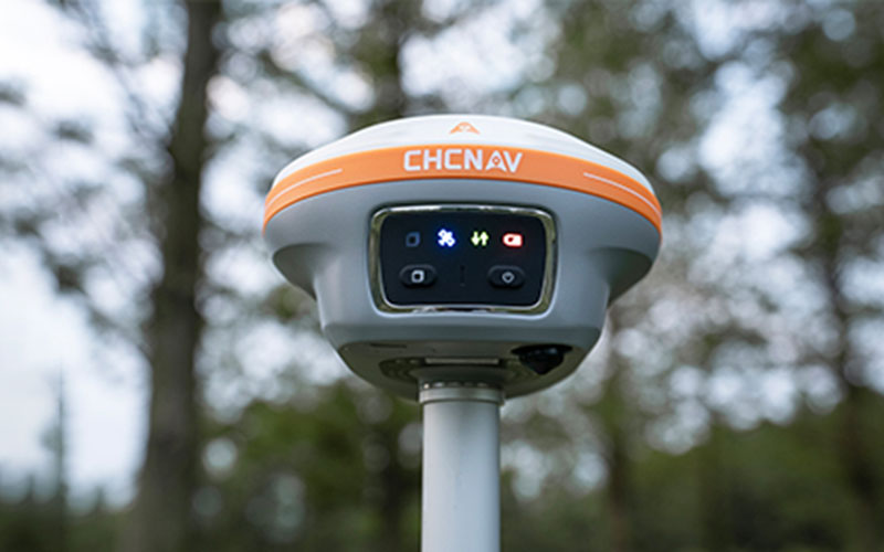

CHCNAV i89 Visual IMU-RTK GNSS Receiver
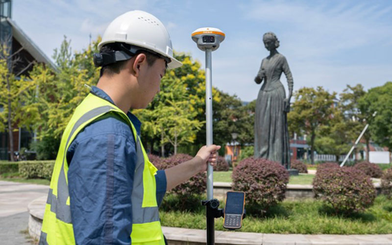
The CHCNAV i89 is a compact GNSS RTK receiver designed for surveyors who need visual measurement capabilities in a lightweight field instrument.
At only 750 g, the i89 combines GNSS, a 200 Hz Auto-IMU and dual cameras in one compact receiver. Its visual surveying functions can help measure difficult-to-reach points, while AR navigation and stakeout provide additional guidance during field operations.
The i89 is also designed to maintain reliable GNSS positioning in challenging conditions. CHCNAV's iStar 2.0 technology includes ionospheric interference mitigation for improved RTK performance, including in areas affected by high solar activity.
RTKSurvey supplies the CHCNAV i89 for surveying, construction, mining and mapping applications.
Key Features
Compact 750 g Design
The i89 is designed for surveyors who spend long periods working in the field. Its lightweight body reduces the load carried by the operator while retaining GNSS, IMU and visual surveying functions.
Dual-Camera Visual Surveying
The integrated cameras can be used to collect survey-grade 3D coordinates and assist with measurement of points that are difficult to access directly.
200 Hz Auto-IMU
The automatic IMU system supports pole tilt compensation without requiring repeated manual initialization. The manufacturer specifies 3 cm accuracy across a 60° tilt range.
Reliable GNSS Tracking
The i89 uses 1408-channel GNSS technology together with iStar 2.0 and ionospheric interference mitigation to improve RTK reliability in challenging signal environments.
AR Navigation and Stakeout
Visual navigation and AR stakeout functions provide field guidance for locating and measuring target points.
3D Modeling Support
The receiver can capture video data for photogrammetric workflows and is compatible with standard 3D modeling software.
Rugged Field Construction
The i89 is IP68-rated and designed to withstand a 2 m pole drop, making it suitable for demanding outdoor survey work.
Applications
The CHCNAV i89 is suitable for:
Topographic surveying
Construction surveying
Mining surveying
Engineering surveying
Visual point measurement
Construction stakeout
3D modeling
Mapping
Field data collection
Technical Specifications
GNSS and IMU
GNSS: Full GNSS
Channels: 1408
IMU: 200 Hz
Maximum positioning precision: 0.8 cm H / 1.5 cm V
Tilt compensation: supported
Visual Functions
Cameras: Dual
Visual surveying: supported
AR navigation: supported
AR stakeout: supported
3D modeling: supported
Communication
Wireless: Bluetooth, Wi-Fi and NFC
UHF modem: 410–470 MHz, Rx/Tx
Physical Specifications
Weight: 0.75 kg
Dimensions: 133 × 87 mm
Battery life: up to 16.5 hours as RTK rover
Protection rating: IP68
Drop resistance: 2 m
Operating temperature: -40°C to +65°C
Why Choose the CHCNAV i89?
The i89 is particularly suited to surveyors who value portability without giving up visual surveying functions.
Its compact form, dual cameras and Auto-IMU make it a practical option for daily topographic, construction and mining surveys where equipment weight and field efficiency are important considerations.
RTKSurvey supplies the CHCNAV i89 for professional surveying and mapping projects.
Related Products
CHCNAV i76 Visual GNSS RTK Receiver
CHCNAV i85 Laser IMU-RTK GNSS Receiver



