Welcome to RTKSurvey.com

CHCNAV ViLi i100 Visual-LiDAR GNSS RTK Receiver
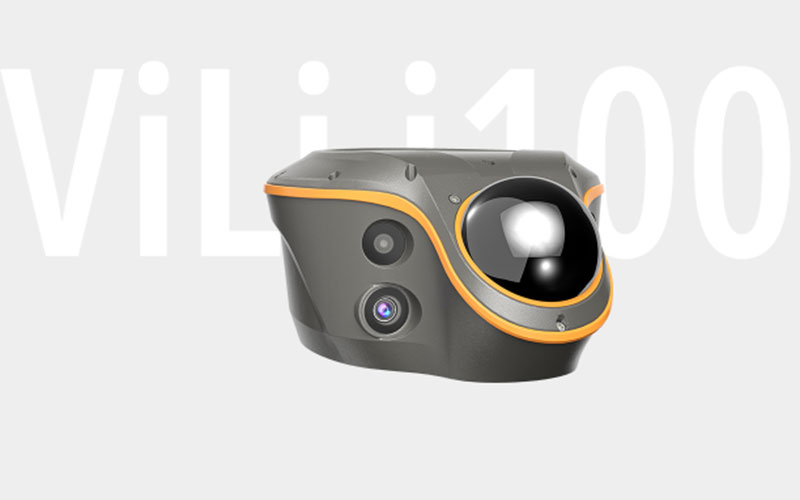
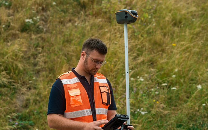
The CHCNAV ViLi i100 is a Visual-LiDAR GNSS RTK receiver designed for surveying conditions where conventional GNSS positioning can become difficult.
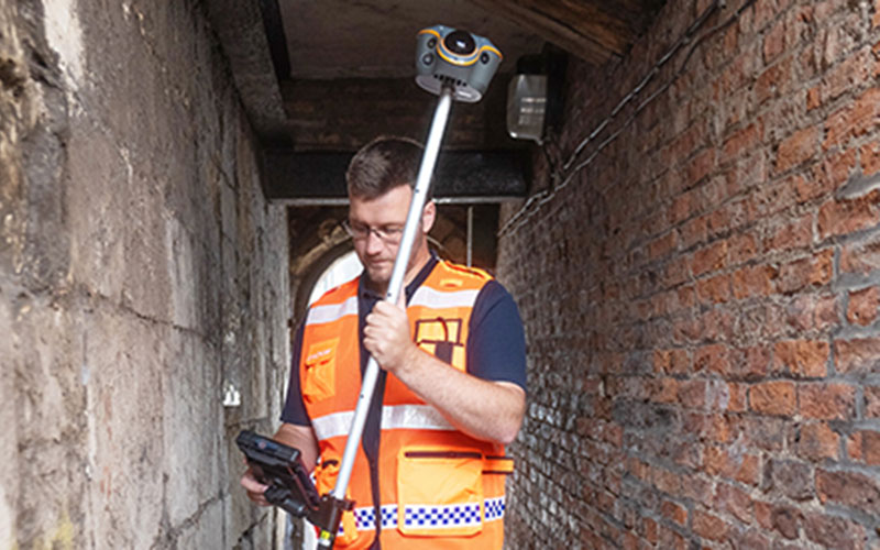
The system combines GNSS RTK, LiDAR, cameras and SLAM-based positioning to extend measurement into obstructed and GNSS-denied environments. It can capture 3D point data without requiring the surveyor to physically occupy every target point.
The ViLi i100 also supports real-time earthwork volume calculations and contactless point capture. With its LiDAR system and visual measurement functions, it provides a different workflow from a conventional GNSS RTK receiver.
RTKSurvey.com supplies the CHCNAV ViLi i100 for professional surveying, construction, earthwork and 3D mapping applications.
Key Features
GNSS + LiDAR + Visual Surveying
The ViLi i100 combines conventional GNSS positioning with LiDAR and visual measurement technology, allowing surveyors to select the most appropriate measurement method for different site conditions.
Surveying in GNSS-Denied Areas
Its SFix 2.0 positioning engine uses LiDAR and SLAM constraints to maintain positioning capability in areas where GNSS signals are unavailable or severely obstructed.
5 cm Accuracy in Difficult Conditions
CHCNAV specifies 5 cm accuracy in challenging GNSS environments and up to 5 cm accuracy within 20 m in GNSS-denied conditions under the stated specifications.
High-Speed LiDAR
The LiDAR system captures up to 860,544 points per second, providing detailed 3D data for field measurement and point cloud applications.
Contactless Point Capture
Vi-LiDAR allows a scene to be captured and multiple target points to be selected afterward, reducing the need for precise aiming at every individual point.
Earthwork Volume Calculation
The system can work with LandStar software to calculate cut-and-fill volumes from 3D point cloud data directly in the field.
Rugged Integrated Design
The ViLi i100 is rated IP67 and designed to withstand a 2 m drop for outdoor surveying applications.
Applications
The CHCNAV ViLi i100 is suitable for:
GNSS-obstructed surveying
GNSS-denied surveying
Contactless surveying
Earthwork volume calculation
Stockpile measurement
Construction surveying
Topographic surveying
3D point cloud collection
Engineering surveying
Difficult-access point measurement
Technical Specifications
GNSS and IMU
GNSS: Full GNSS
IMU: 200 Hz
Maximum positioning precision: 0.8 cm H / 1.5 cm V
Positioning technology: GNSS + LiDAR + SLAM
Visual System
Cameras: Four
Visual surveying: supported
Contactless point capture: supported
LiDAR
Range: 30m@10% reflectivity; 70m@80% reflectivity
Field of view: H 360°, V 90°
Point frequency: 860,544 points/sec
Typical accuracy: 1.5cm
Laser classification: Class 1 eye-safe
Communication
Wireless: Bluetooth and Wi-Fi
UHF modem: 410–470 MHz, Rx only
USB: USB 3.0 Type-C
UHF antenna port: supported
Physical Specifications
Weight: 1.39 kg
Protection rating: IP67
Drop resistance: 2 m
Operating temperature: -20°C to +55°C
Field Controller
The ViLi i100 rover kit can be supplied with a rugged Android tablet for field data collection and processing. The system works with CHCNAV LandStar software for surveying, point cloud and earthwork workflows.
Why Choose the CHCNAV ViLi i100?
The ViLi i100 is intended for projects where conventional GNSS RTK measurement is limited by physical access or satellite visibility.
Its combination of GNSS, LiDAR, visual measurement and SLAM technology allows surveyors to collect 3D information without relying exclusively on direct point occupation. This makes it particularly relevant to construction, earthwork and difficult-access surveying.
RTKSurvey.com supplies the CHCNAV ViLi i100 for professional surveying and engineering applications. Contact RTKSurvey for product information, quotations and international orders.
Related Products
CHCNAV i85 Laser IMU-RTK GNSS Receiver
CHCNAV i89 Visual IMU-RTK GNSS Receiver
CHCNAV i93 IMU-RTK GNSS Receiver



