Welcome to RTKSurvey.com



ComNav Jupiter Laser RTK GNSS Receiver
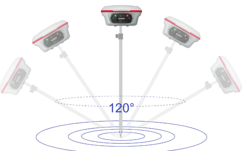
The ComNav Jupiter is a laser RTK GNSS receiver that brings GNSS positioning, laser measurement, dual-camera visual stakeout and Auto-IMU into one field instrument. Its laser can reach up to 50 m, while the visual system provides camera-based guidance for stakeout operations. The receiver also supports multi-constellation GNSS tracking, multiple correction protocols and up to 120° tilt compensation. RTKSurvey supplies the Jupiter for surveying and construction workflows that require flexible measurement methods.
Key Features
• 1668-channel multi-frequency GNSS tracking
• Green laser with up to 50 m measurement range
• Dual-camera visual stakeout
• Auto-IMU with up to 120° tilt compensation
• 2.5 cm tilt survey accuracy
• PPP support through B2b and HAS
• OLED color display
• UHF data link with up to 15 km range under ideal conditions
• 16-hour operating time
• IP67 protection
Core Specifications
GNSS Channels: 1668
RTK Accuracy: H 8 mm + 1 ppm RMS; V 15 mm + 1 ppm RMS
RTK Initialization: <5 s with baseline ≤10 km
Tilt Compensation: Up to 120°, 2.5 cm accuracy
Laser Range: Up to 50 m
Laser Accuracy: (3–5) mm + 1 ppm at room temperature
Laser Safety: Class 3R
Laser Measurement Frequency: 3 Hz typical; 5 Hz maximum
UHF Frequency: 410–470 MHz
UHF Transmit Power: 0.5 W / 1 W / 2 W adjustable
UHF Range: 3–15 km
Battery: 5000 mAh
Operating Time: Up to 16 hours
Weight: 810 g with internal battery
Display: 1.1-inch OLED color display
Memory: 4 GB
Protection: IP67
Operating Temperature: -40°C to +65°C
Applications
The Jupiter can be used for topographic surveying, construction stakeout, infrastructure projects, cadastral work and measurements involving inaccessible or obstructed points. Its laser and visual functions provide additional options when conventional pole-based measurement is difficult.
Related Products



